Jitjai Co., Ltd.
WE PROVIDES 3D Capturing
3D Capturing
Arial Mapping
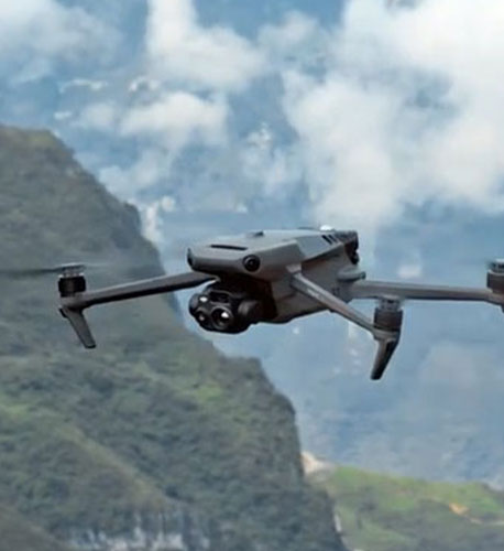
Photogrammetry Drone
ผู้ให้บริการ LiDAR Solution เพื่อการทำแผนที่ที่แม่นยำด้วยการใช้ SLAM โดยสามารถทำงานได้ในสภาพแวดล้อมทั้ง indoor และ outdoor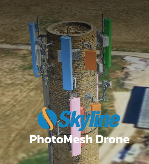
Skyline PhotoMesh Drone
Hybrid photogrammetric processing of images with LiDAR3D Capturing
Terrestrial Scanning
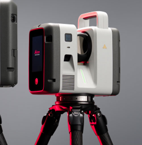
Leica RTC Series
ยกระดับการบันทึกภาพเสมือนจริงไปอีกขั้น ด้วยดีไซน์ที่มั่นใจได้ กับประสิทธิภาพ 3 ระดับที่คุณเลือกได้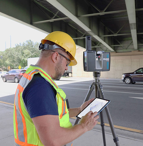
FARO® Focus Laser Scanning Solution
FARO® Focus – เก็บข้อมูลได้เร็วกว่า ด้วยเทคโนโลยี Hybrid Reality Capture™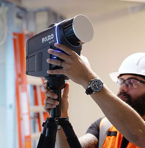
FARO® Blink™ Imaging Laser Scanner
Reality Capture รูปแบบใหม่ ที่เร็วและเรียบง่ายยิ่งกว่าเดิม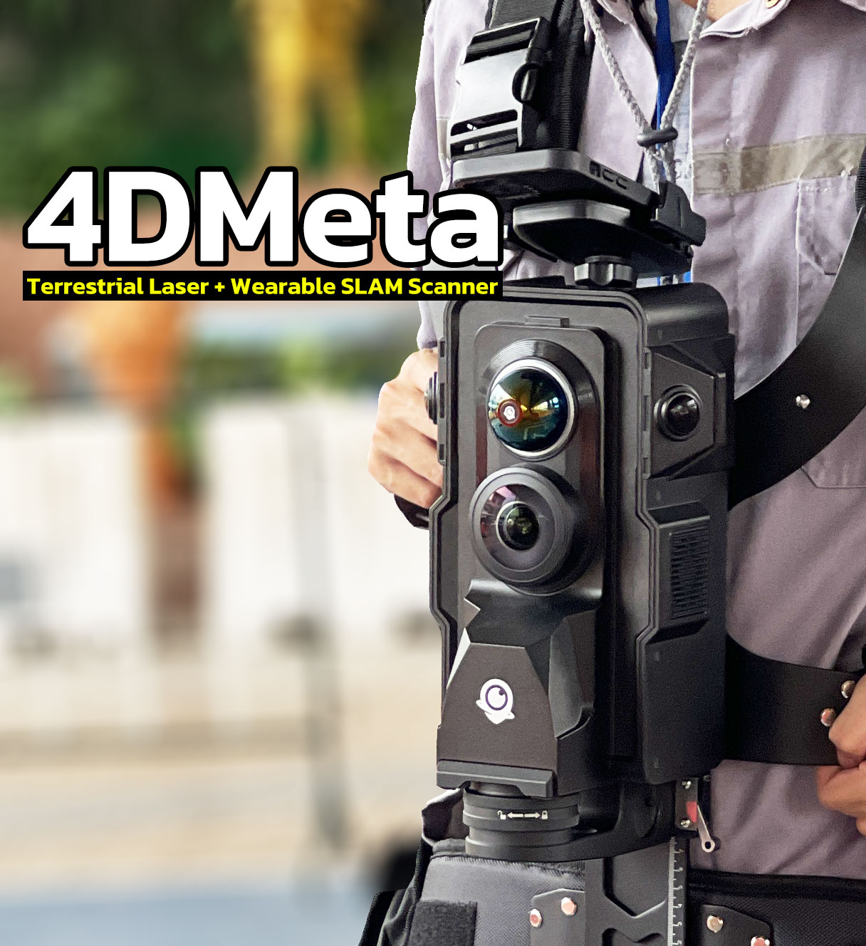
4DMeta
การสแกนแบบ Terrestrial Laser+ Wearable SLAM: รองรับการสแกนแบบคงที่ (Terrestrial) และแบบพกพา (Wearable SLAM) เหมาะสำหรับการใช้งานหลากหลายประเภท3D Capturing
Mobile & SLAM Scanning
GreenValley International
ผู้ให้บริการ LiDAR Solution เพื่อการทำแผนที่ที่แม่นยำด้วยการใช้ SLAM โดยสามารถทำงานได้ในสภาพแวดล้อมทั้ง indoor และ outdoor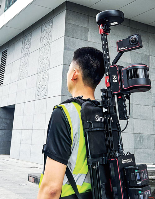
OmniSLAM R8+
OmniSLAM R8+ ระบบ SLAM สำหรับงานสำรวจทำแผนที่ 3D ความละเอียดระดับ CM.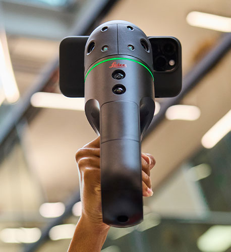
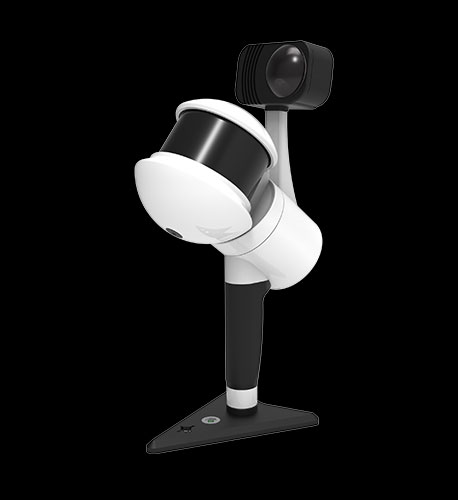
Leica2GO BLKPluse
The Leica BLK2GO PULSE is a handheld first-person laser scanner. Instantly capture what you need, when you need it, from your point of view. Using new, advanced reality capture technology, the BLK2GO PULSE delivers complete,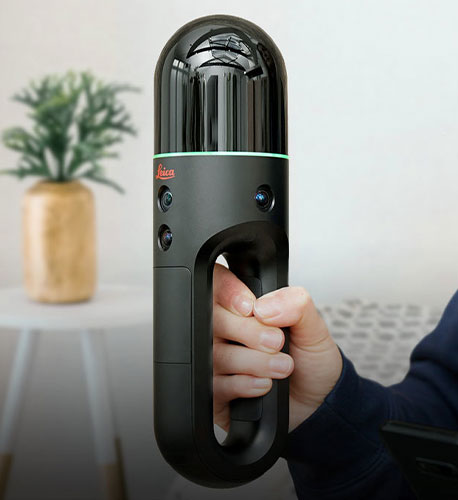
Leica BLK2GO
The BLK2GO handheld imaging laser scanner recreates spaces in 3D as you move. It captures images and dimensionally accurate point clouds in real-time and uses SLAM technology to record your trajectory through space.3D Capturing
AR Smart Devices
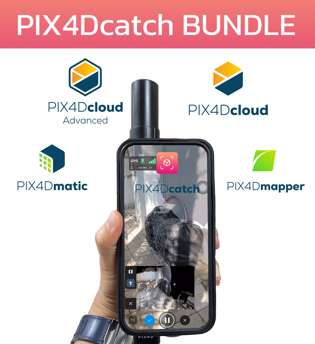
Pix4D Catch Product Solutions
แอพพลิเคชั่นที่สามารถดาวน์โหลดได้ฟรีบนมือถือและแท็บเล็ตในระบบ iOS, Android เพื่อเปลี่ยนอุปกรณ์ของคุณให้เป็น Laser Scanner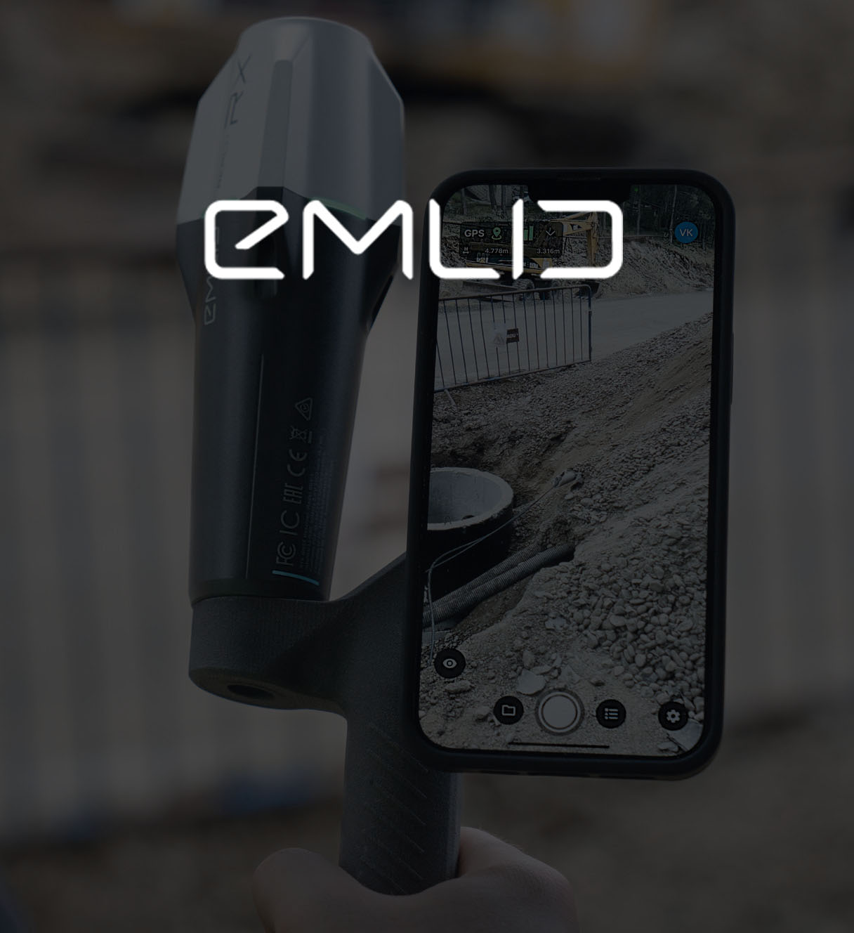
EMLID
High-precision RTK GNSS receivers and software for the field and the officeWe Provides 3D LiDAR Solution Including TLS/MMS/SLAM/Handheld with most effective processing software for cutomer applications.
We have an experienced team to guide you through each workflows until you are proven with justifiable solutions that also aligned with your resource and business roadmap.
Read More