Jitjai Co., Ltd.
WE PROVIDES Geospatial Data Platform
OUR PRODUCTS
Geospatial Data Platform
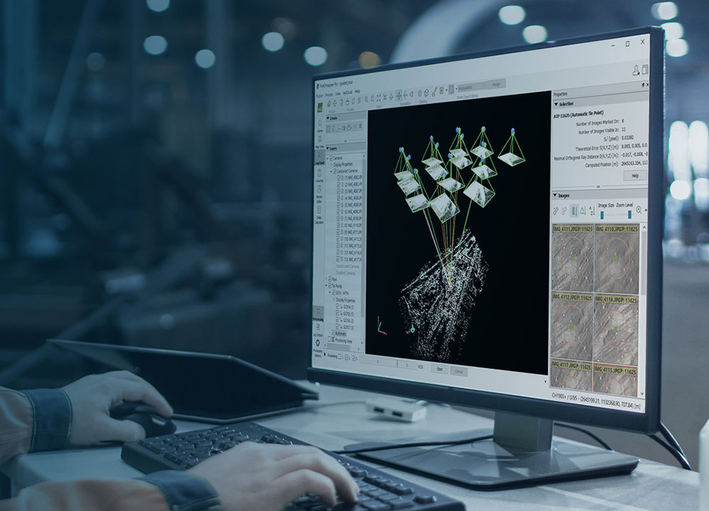
PIX4D
โปรแกรมในตระกูล Pix4D โปรแกรมอัจฉริยะที่ช่วยจัดการข้อมูลจากภาพถ่ายทางอากาศของคุณได้อย่างลงตัว ทำแผนที่ วางแผนการบิน รองรับการทำงานบน Desktop พร้อมอัพโหลดขึ้น Cloud ได้ทันที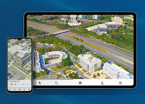
SKYLINE
Skyline Platform คือศูนย์กลางการรวมศูนย์ข้อมูล Digital twin ที่ให้คุณ สร้าง, วิเคราะห์, และ แชร์ โลกดิจิทัลของคุณอย่างไร้ขีดจำกัด ทั้งหมดจบในที่เดียว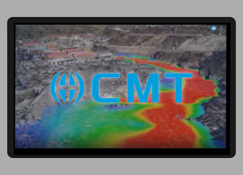
3D Digital Twin
CMT Smart Construction – แพลตฟอร์มบริหารงานก่อสร้างอัจฉริยะ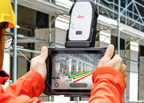
VGIS - Collaboration Platform
vGIS เป็นแพลตฟอร์มการแสดงผล XR ระดับแนวหน้า ซึ่งสามารถแปลงข้อมูล BIM, GIS, Reality Capture และข้อมูลเชิงพื้นที่รูปแบบอื่น ๆ ให้กลายเป็นการแสดงผล Augmented Reality ที่สวยงามและรองรับการใช้งานจริงในภาคสนาม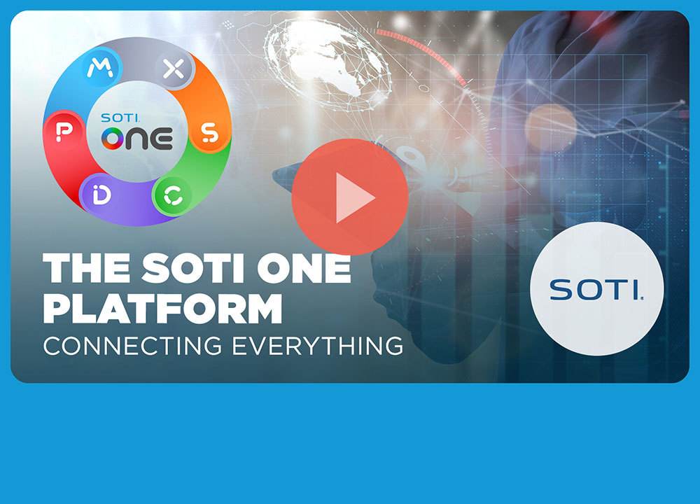
SOTI
แพลตฟอร์ม SOTI ONE มอบการควบคุมและมุมมองที่ครอบคลุมอุปกรณ์เคลื่อนที่ทั้งหมดของคุณ ไม่ว่าจะเป็นสมาร์ทโฟน แท็บเล็ต คอมพิวเตอร์ อุปกรณ์ทนทานพิเศษ เครื่องพิมพ์อุตสาหกรรม และอื่นๆ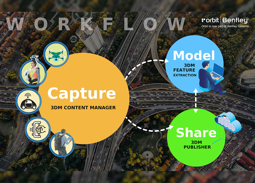
Bentley iTwin
With Orbit 3DM solutions, efficiently manage, analyze, and share massive amounts of reality data of any size from any system, including point cloud, imagery,textured mesh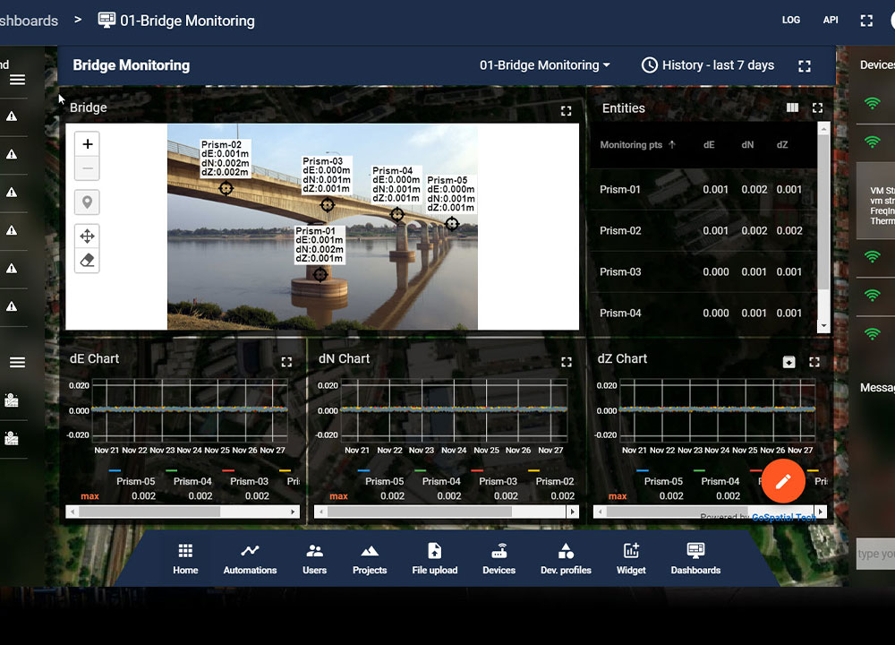
GS Vault
GS Vault เป็น platform ในการรวบรวมและควบคุมข้อมูล geospatial จากทุก senser ของคุณ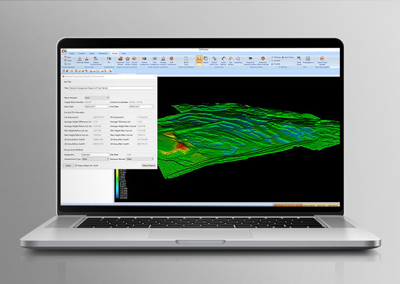
Co-Process
โปรแกรมจัดการข้อมูล Point cloud ไม่ว่าจะเป็นข้อมูลที่ได้จากการสำรวจWe Provides 3D LiDAR Solution Including TLS/MMS/SLAM/Handheld with most effective processing software for cutomer applications.
We have an experienced team to guide you through each workflows until you are proven with justifiable solutions that also aligned with your resource and business roadmap.
Read More