Jitjai Co., Ltd.
WE PROVIDES Engineering & Analysis Software
OUR PRODUCTS
Engineering & Analysis Software
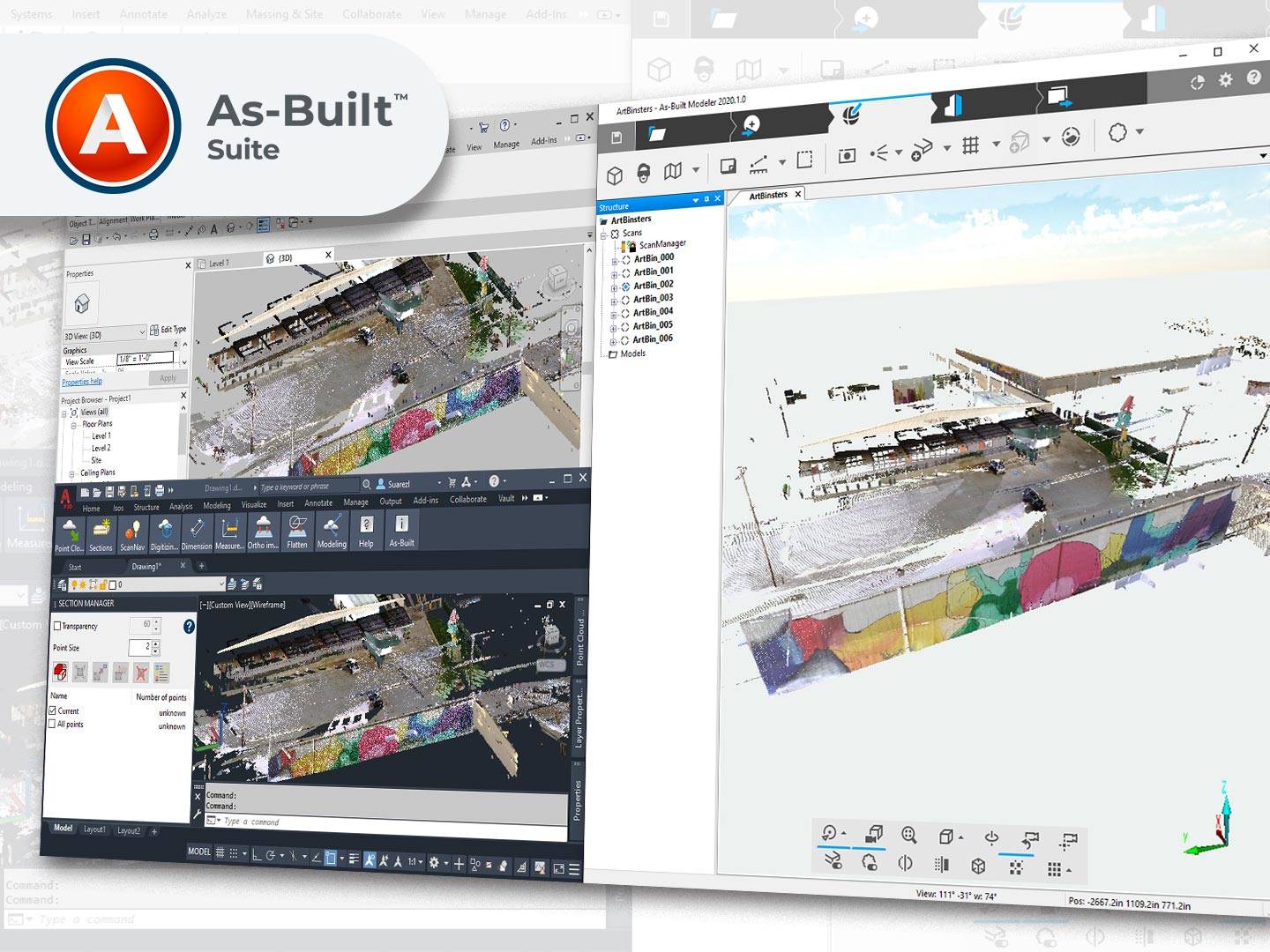
FARO® As-BuiltTM Software Suite
ขึ้นโมเดล CAD และ BIM จากข้อมูล point cloud ได้โดยตรงในโปรแกรม Autodesk® ที่ใช้อยู่ ในรูปแบบของ Plug-ins ทำให้สามารถใช้งานได้ง่ายและเร็ว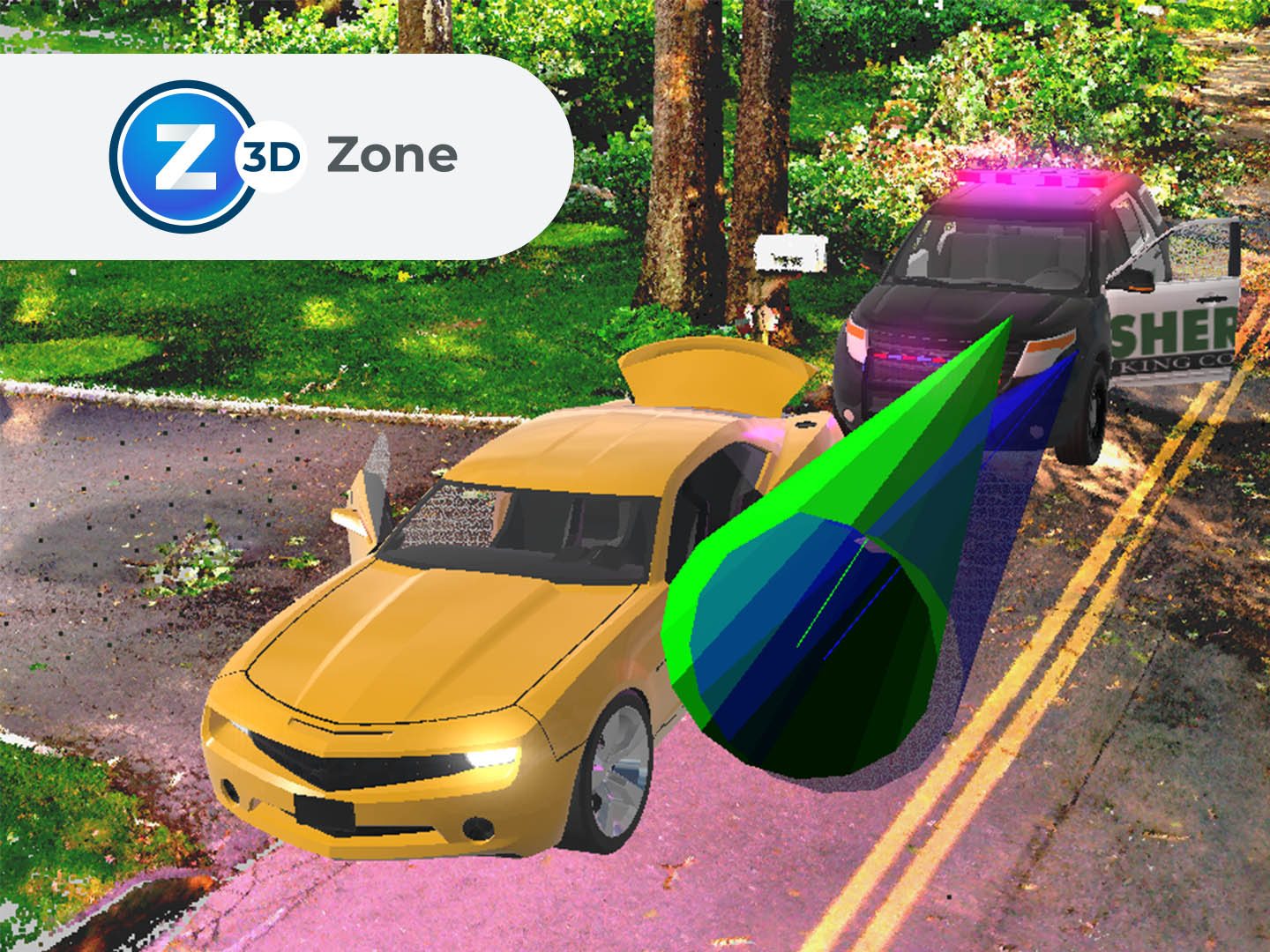
FARO Zone 3D
โซลูชันที่เหมาะสำหรับมืออาชีพ ในการบังคับการใช้ กฎหมายการสืบสวนทางนิติวิทยาศาสตร์ การให้บริการด้านอัคคีภัย การรักษาความปลอดภัย การประกันภัยและการป้องกันอัคคีภัย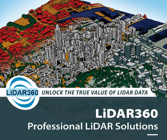
LiDAR360
Point Cloud & Images Post-Processing and Industry Applications Software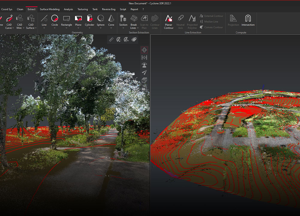
Leica Cyclone 3DR
โปรแกรมประมวลผลข้อมูล 3มิติ (Point Cloud) จาก Airborne Laser Scanning (ALS), Mobile Laser Scanning (MLS), Terrestrial Laser Scanner (TLS) และ Photogrammetry sensorsอ่านเพิ่มเติม คลิ๊กที่นี่
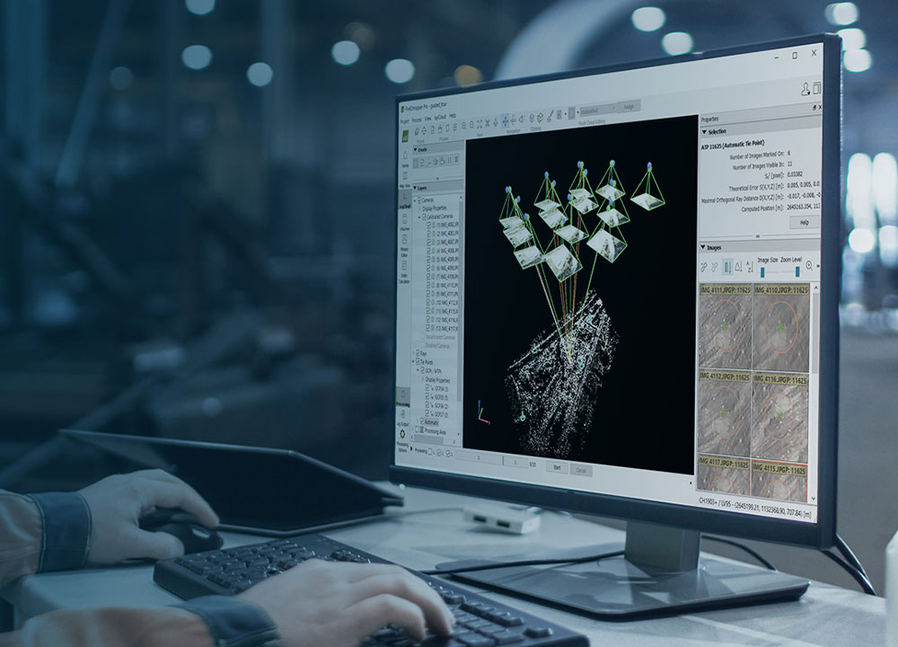
PIX4D
โปรแกรมในตระกูล Pix4D โปรแกรมอัจฉริยะที่ช่วยจัดการข้อมูลจากภาพถ่ายทางอากาศของคุณได้อย่างลงตัว ทำแผนที่ วางแผนการบิน รองรับการทำงานบน Desktop พร้อมอัพโหลดขึ้น Cloud ได้ทันที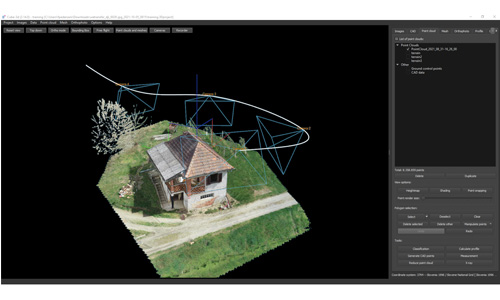
Cube 3D
Cube-3d Software Photogrammetry & 3D data softwareWe Provides 3D LiDAR Solution Including TLS/MMS/SLAM/Handheld with most effective processing software for cutomer applications.
We have an experienced team to guide you through each workflows until you are proven with justifiable solutions that also aligned with your resource and business roadmap.
Read More