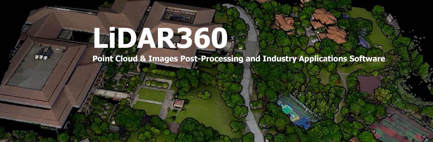
LiDAR360 V.9: แพลตฟอร์มมืออาชีพ ประมวลผลพอยต์คลาวด์ขนาดใหญ่อย่างครบวงจร
เปิดตัวในปี 2013, LiDAR360 คือแพลตฟอร์มมืออาชีพสำหรับประมวลผลพอยต์คลาวด์ขนาดใหญ่ แพลตฟอร์มนี้ใช้มากกว่า 10 อัลกอริทึมพอยต์คลาวด์ชั้นนำระดับสากล พร้อมด้วยปัญญาประดิษฐ์และการเรียนรู้ของเครื่อง ช่วยส่งเสริมการใช้งาน LiDAR ในอุตสาหกรรม แก้ปัญหาการประยุกต์ใช้งาน และปลดล็อกศักยภาพเต็มที่ของข้อมูลพอยต์คลาวด์ของผู้ใช้
Function
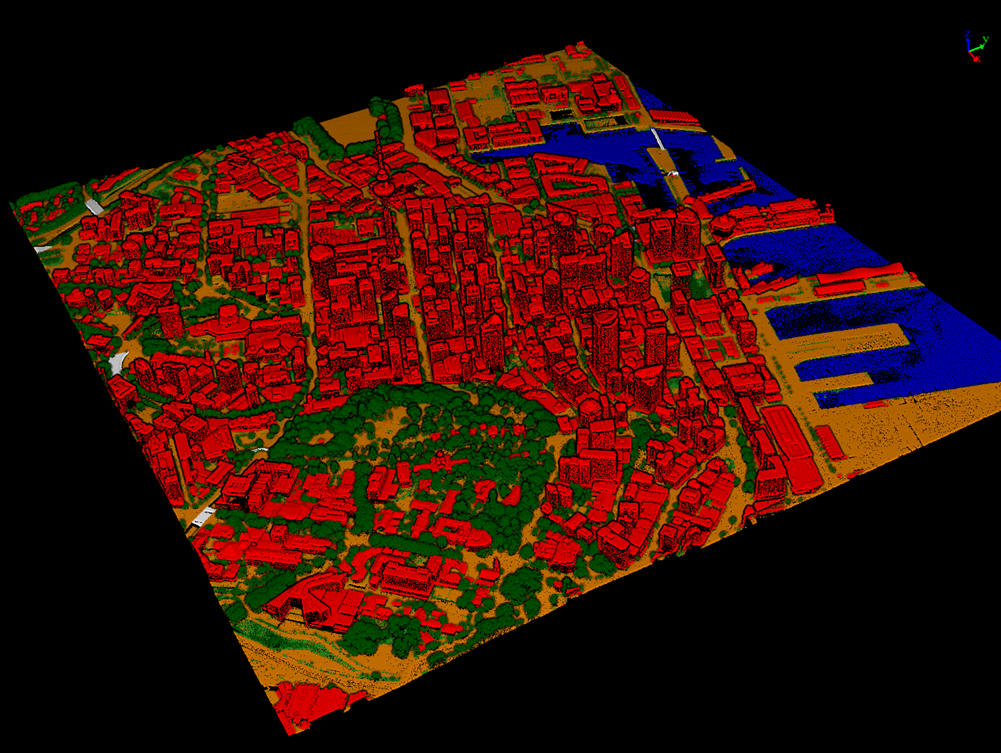
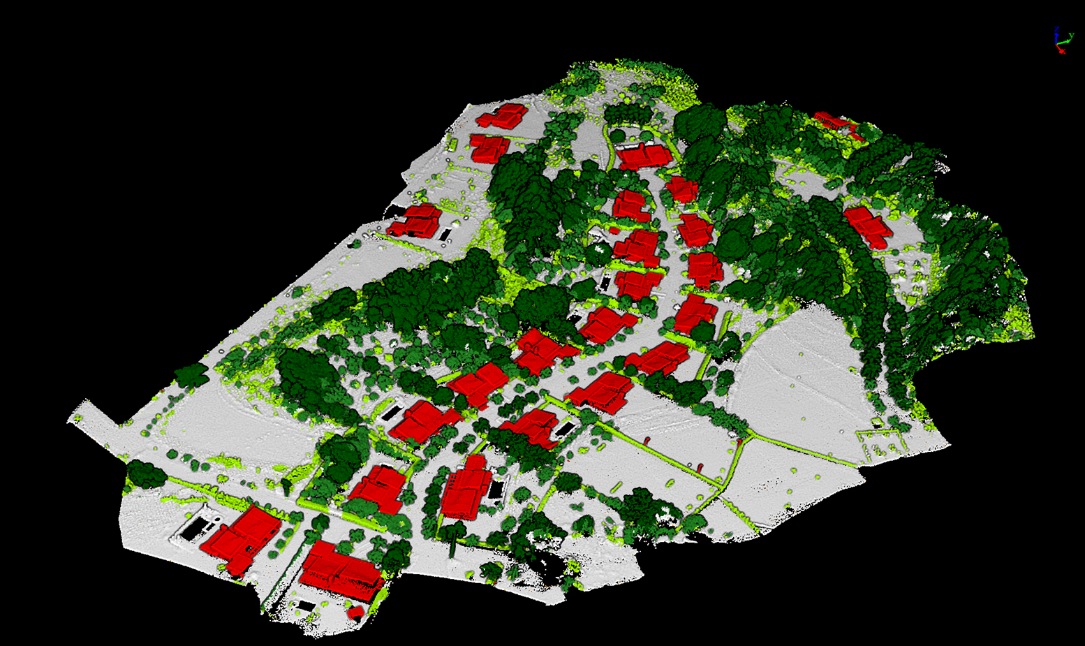
การจำแนกอัตโนมัติด้วย AI
โมดูลการจำแนกลึกซึ้งด้วยเทคโนโลยี AI ช่วยให้สามารถจำแนกอัตโนมัติได้มากกว่า 32 ฟีเจอร์ ผสานการทำงานกับ Segment Anything Model รองรับการสกัดเส้นรอบรูปของฟีเจอร์ใด ๆ จากภาพ การโต้ตอบเพื่อจำแนกพอยต์คลาวด์อย่างชาญฉลาด ทำให้การประมวลผลข้อมูลสะดวกและมีประสิทธิภาพมากขึ้น นอกจากนี้ยังสามารถฝึก AI สำหรับการจำแนกพอยต์คลาวด์และการสกัดฟีเจอร์จากภาพ รองรับความต้องการการผลิตอัตโนมัติในหลายการประยุกต์ใช้งานRich Scene
UAV Urban
UAV Rural
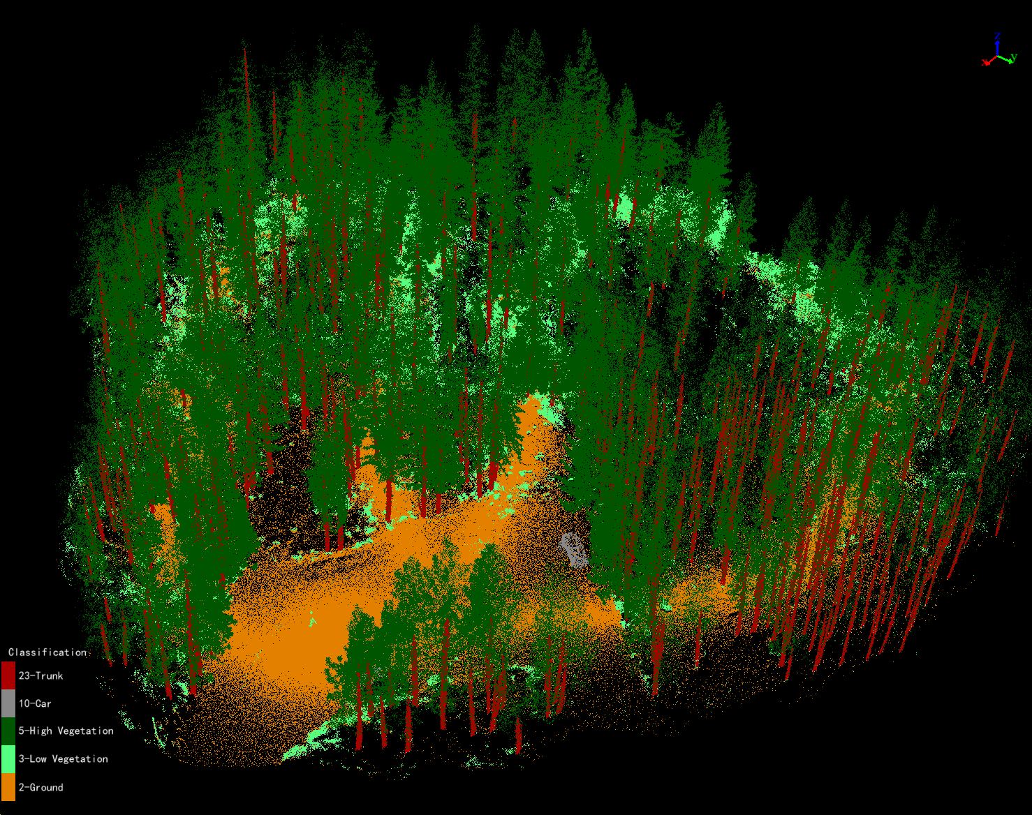
UAV/TLS Forest
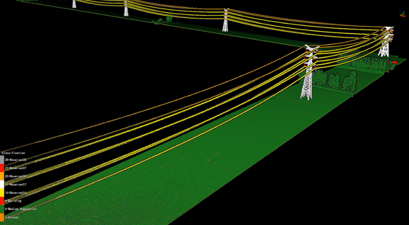
Powerline
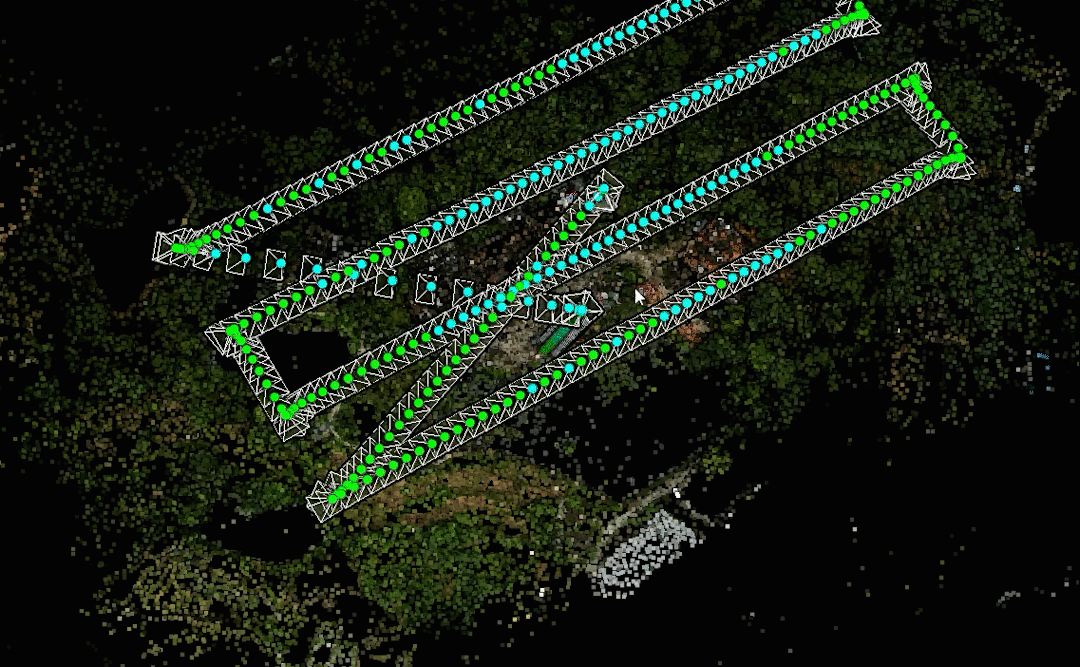
Preprocessing
Processing Video
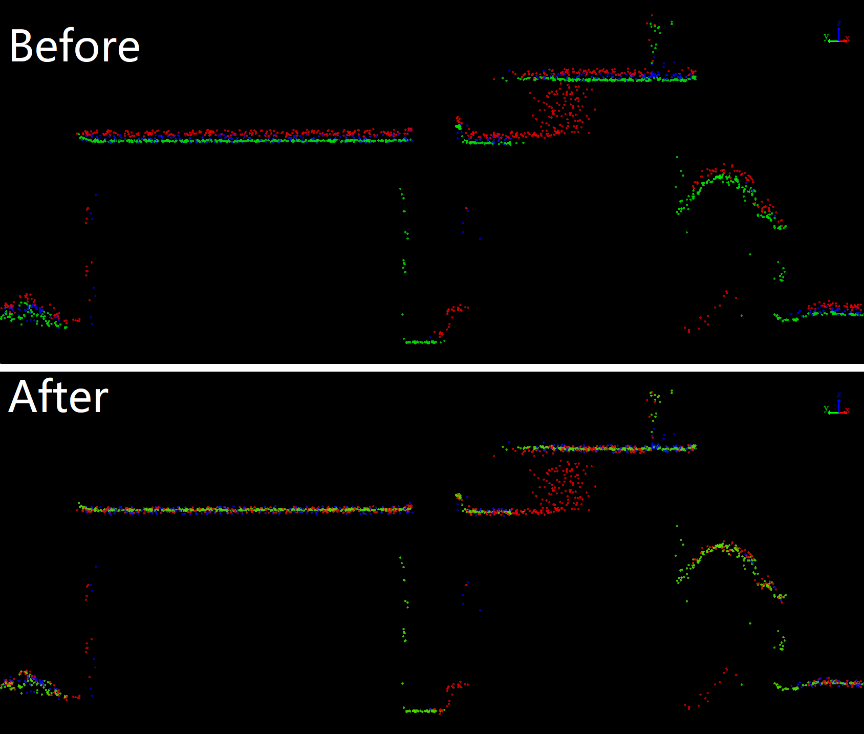
Trajectory Adjustment
Data Registration
Color Adjustment
Photo
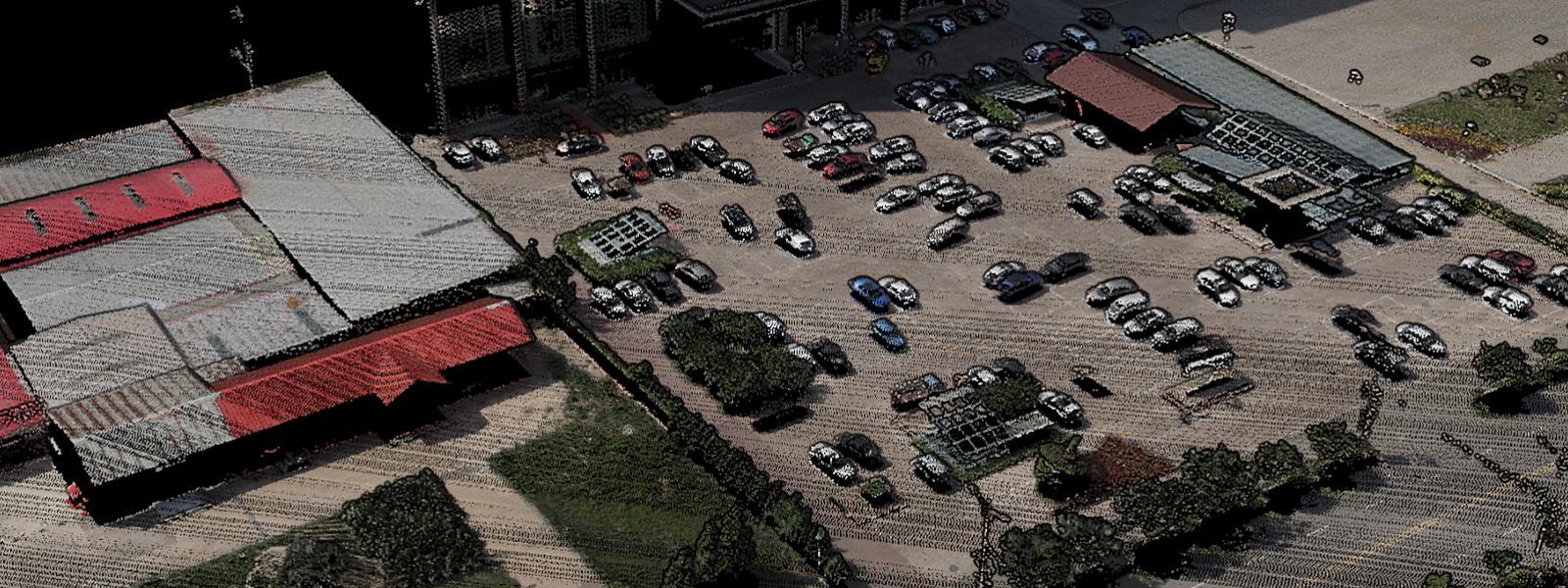
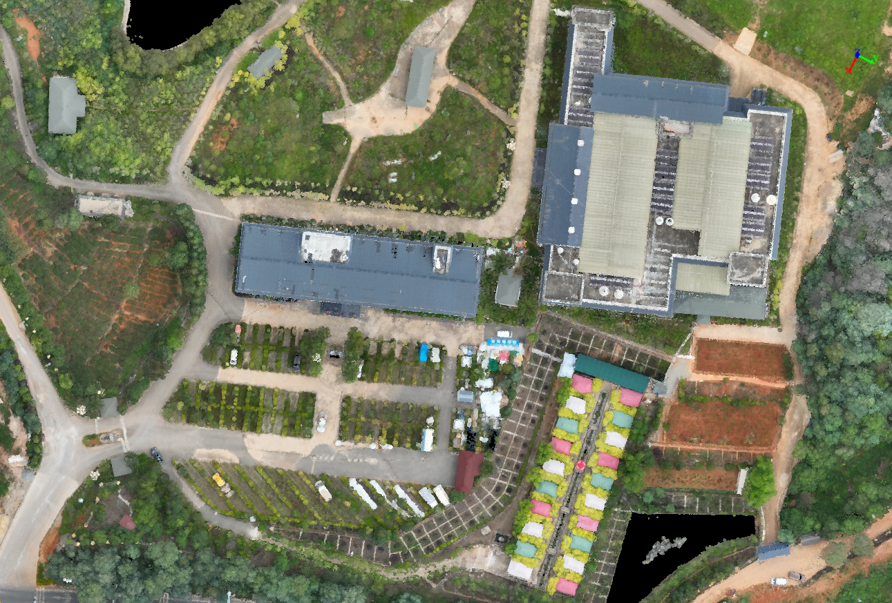
โมดูลภาพถ่ายใหม่ สามารถสร้างภาพออร์โธโฟโต้ RGB, อินฟราเรด และมัลติสเปกตรัม รองรับการตรวจจับเป้าหมายและการจับคู่ GCP อัตโนมัติ ช่วยเพิ่มคุณภาพของโครงการภาพถ่ายและความแม่นยำในการจับคู่พอยต์คลาวด์ มอบข้อมูลที่เชื่อถือได้สำหรับการสกัดฟีเจอร์ การจำแนกด้วย AI การสร้างพื้นผิวอาคาร และ DOM
Photo Module Video
DOM
DOM Editor
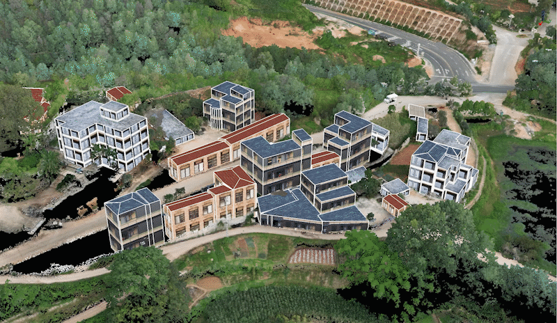
Image Applications
Forestry Application
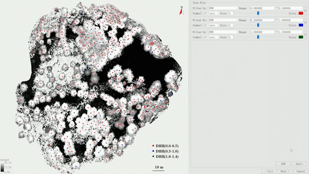
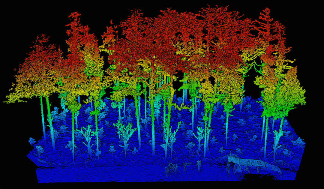
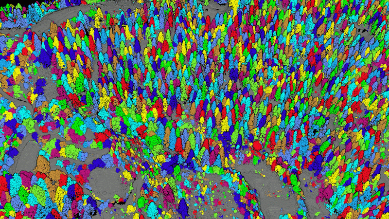
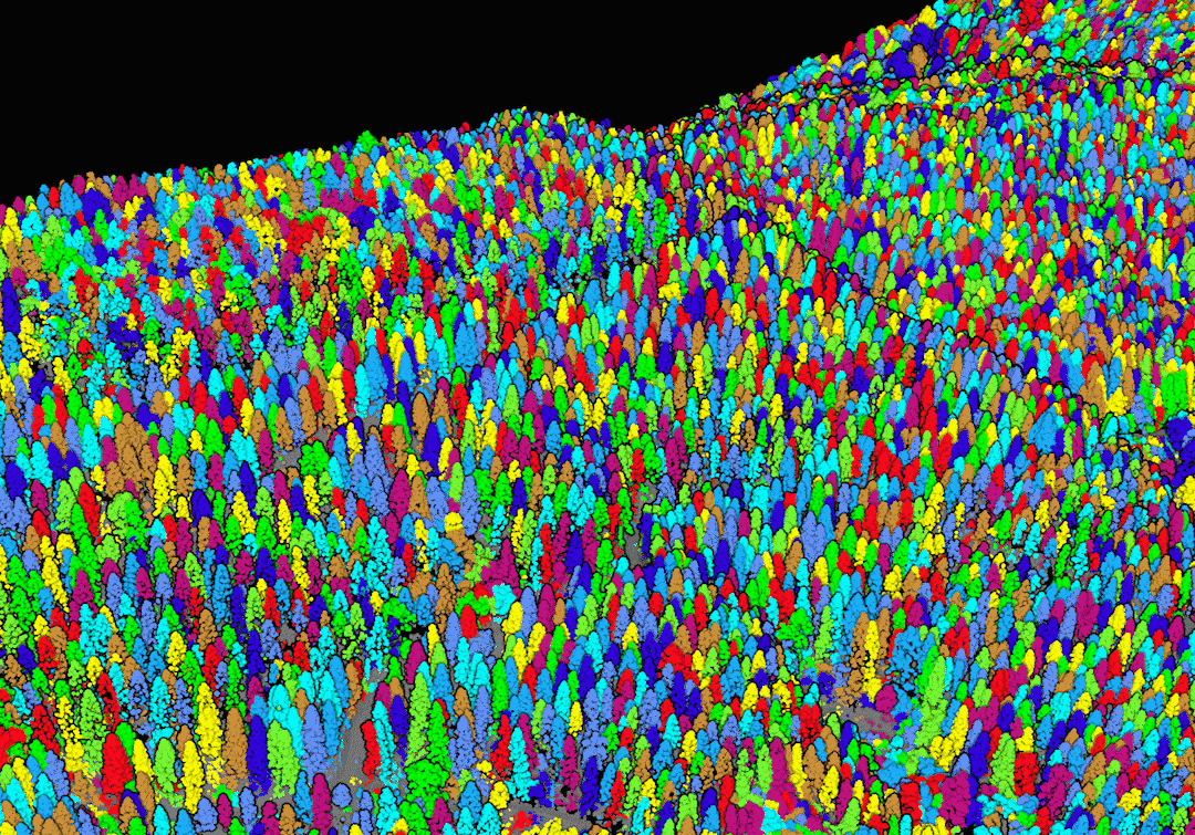
โมดูลป่าไม้สามารถจำแนกต้นไม้และพุ่มไม้ ลำต้นและทรงพุ่ม ตลอดจนต้นไม้แต่ละต้น เก็บคุณลักษณะได้มากกว่า 18 รายการ รวมถึงปริมาตรลำต้น ความโค้ง และชีวมวล รองรับความต้องการสำรวจป่าอย่างละเอียด การจัดการป่าไม้ และการติดตามคาร์บอน มอบคำแนะนำครบวงจรสำหรับการวิเคราะห์และทำแผนที่ป่าไม้ สร้างรายงานต้นไม้แต่ละต้น ปริมาตรรวมของแปลงไม้ การวิเคราะห์การตัดบาง และอื่น ๆ เพื่อมาตรฐานผลลัพธ์การสำรวจ พร้อมแบบจำลองต้นไม้ 70 ชนิดและการแสดงคุณลักษณะของต้นไม้แต่ละต้น เพื่อให้เห็นผลการวิเคราะห์อย่างชัดเจน
Forestry Module Video
Thinning Analysis
Standing Tree Volume Analysis
Tree Model
Display by Attributes
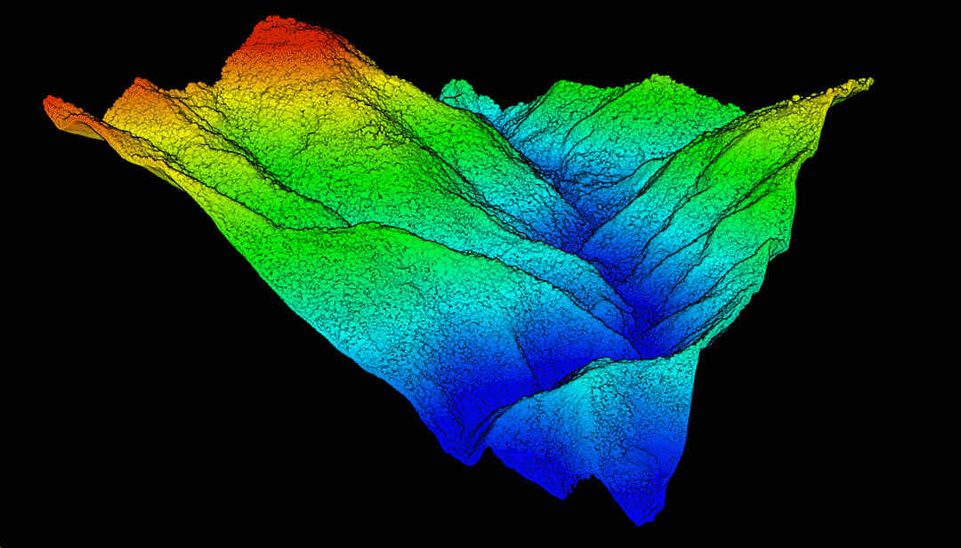
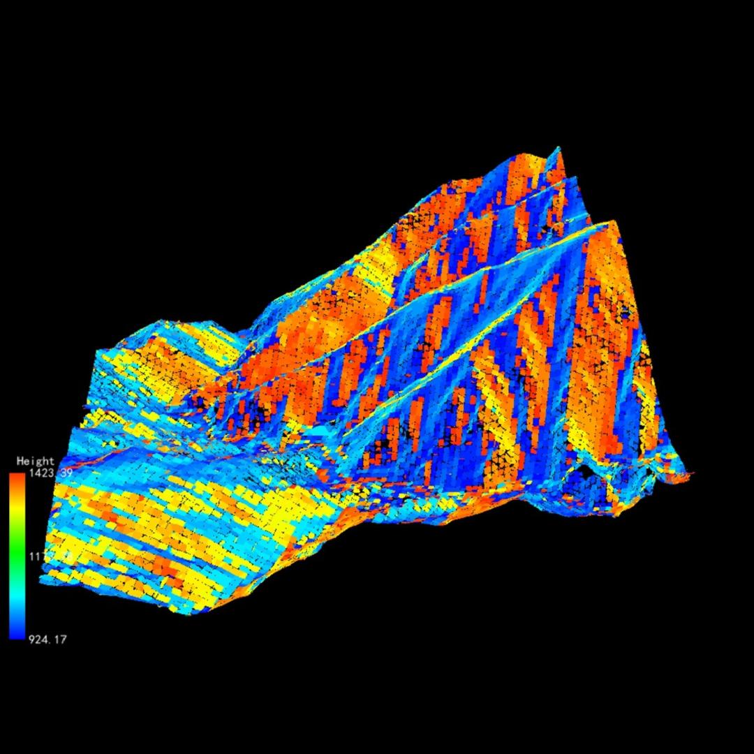
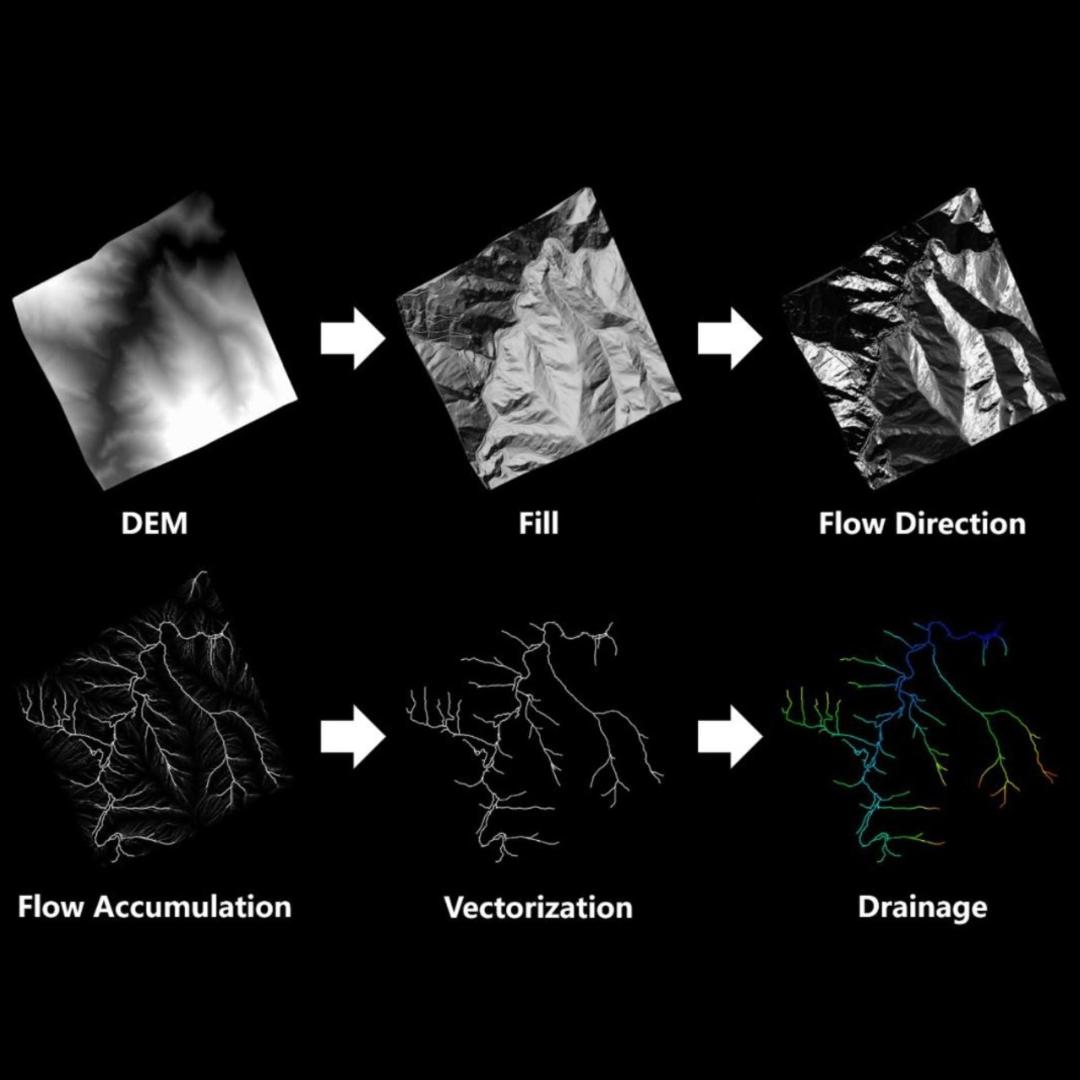
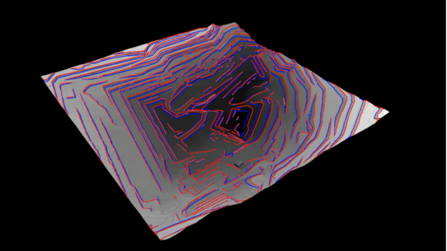
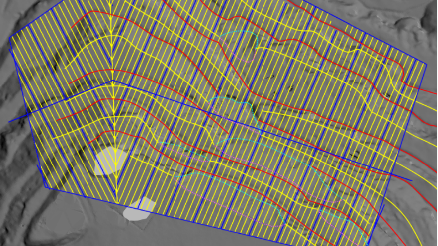
Topographic Mapping
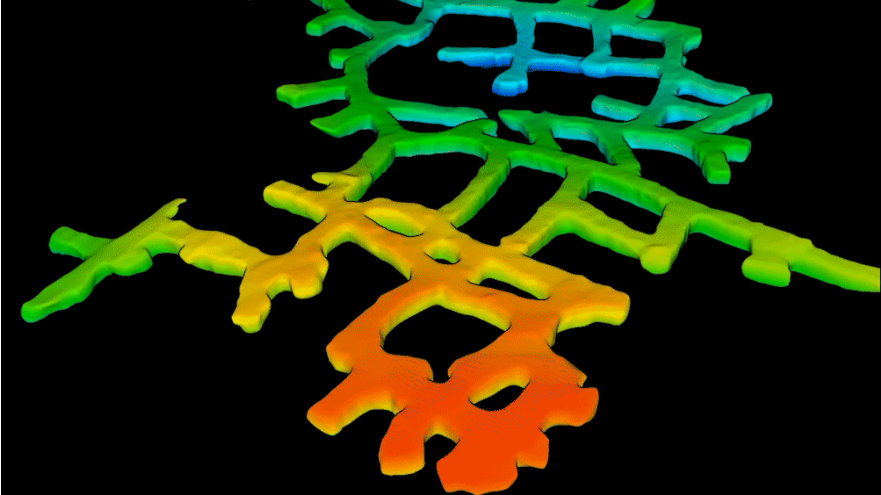
โมดูลภูมิประเทศรองรับกระบวนการทำงานครบวงจรสำหรับการสร้าง ตรวจสอบ และปรับปรุงผลิตภัณฑ์ภูมิประเทศต่าง ๆ เช่น DEM, เส้นชั้นความสูง และอื่น ๆ รองรับผลิตภัณฑ์ภูมิประเทศ 15 ประเภท ใช้งานได้ทั้งการทำแผนที่ภูมิประเทศและงานสำรวจทางธรณีวิทยา บนพื้นฐานข้อมูลภูมิประเทศสามารถสร้าง REM, วิเคราะห์พื้นที่ระบายน้ำและพื้นที่น้ำท่วม ช่วยงานประยุกต์ด้านอุทกวิทยา การวัดปริมาตร ตรวจจับการเปลี่ยนแปลง และวิเคราะห์ตัดขวางให้การสนับสนุนงานสำรวจวิศวกรรมได้อย่างเชื่อถือได้
Vector Module Video
Classification Video
Topographic Surveying
Terrain Analysis
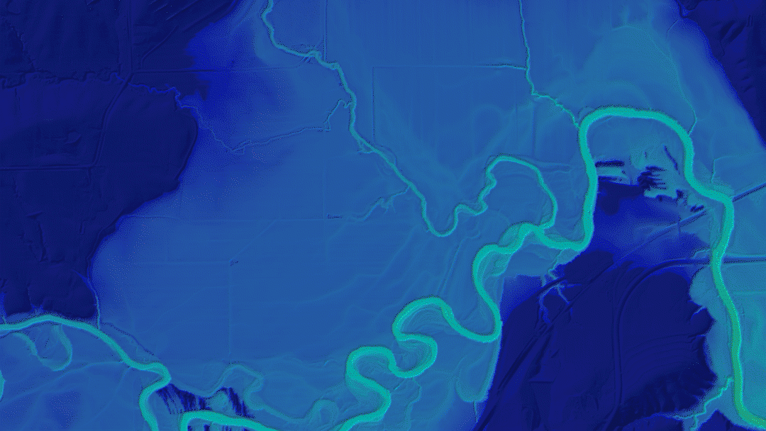
Hydrological Analysis
Geographical Analysis
LiDAR เป็นหนึ่งในเทคโนโลยีการสำรวจระยะไกลไม่กี่ชนิดที่สามารถทะลุพืชพรรณเพื่อเก็บจุดพื้นดินได้ LiDAR360 สามารถสกัดจุดพื้นดินจากพอยต์คลาวด์ LiDAR ได้อย่างแม่นยำ และให้ค่าพารามิเตอร์ต่าง ๆ เช่น ความชันและทิศทางความชันสำหรับการวิเคราะห์ตัดขวางและการเปลี่ยนแปลงภูมิประเทศ รองรับงานสำรวจสิ่งแวดล้อม การเฝ้าติดตามภัยพิบัติ และการสำรวจเหมือง
Structure Analysis
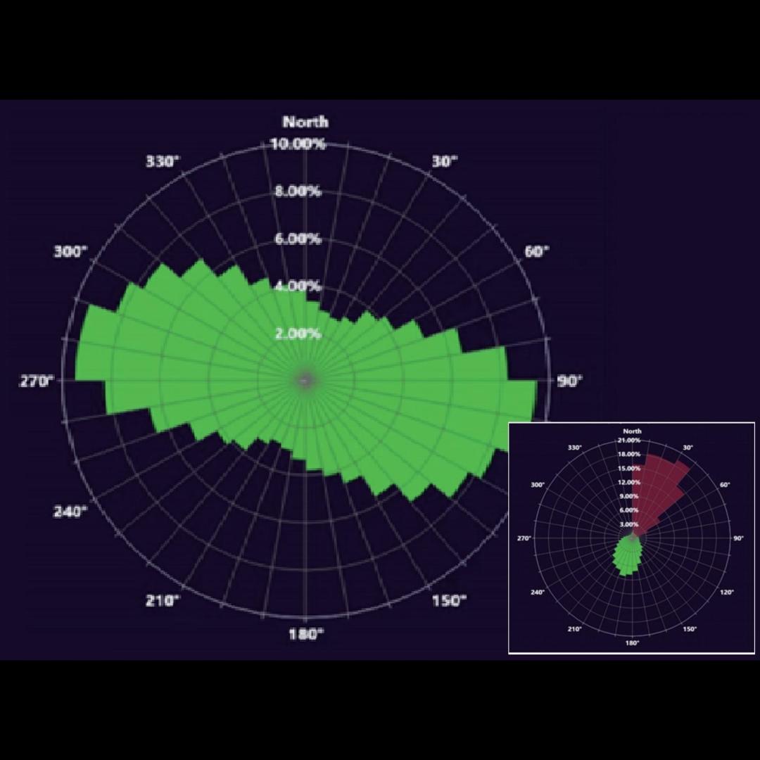
Joint and Strike Diagram
Hydrological Analysis
Mining Application
LiDAR360 มอบการวิเคราะห์ความปลอดภัยในการผลิต การคำนวณปริมาตุดิน และการวิเคราะห์การเปลี่ยนแปลงปริมาตุสำหรับเหมืองเปิด เพื่่อเพิ่มประสิทธิภาพการทำงาน พร้อมสร้างโมเดลอย่างรวดเร็ว การวิเคราะห์ตัดขวาง และการคำนวณปริมาตุสำหรับอุโมงค์ เพื่อสนับสนุนงานก่อสร้าง
Mine Module Video
Tunnel Modeling
Extract Crests and Toes
Inter-Ramp Compliance
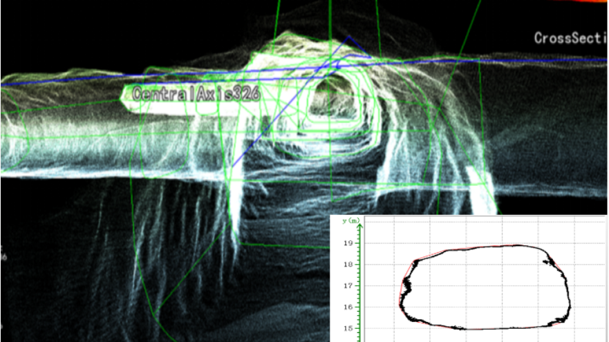
Section Analysis
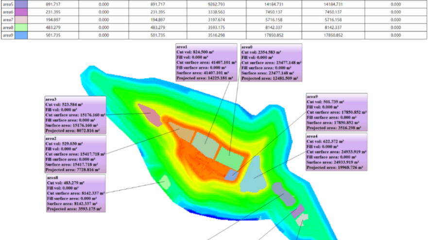
Volume change Analysis
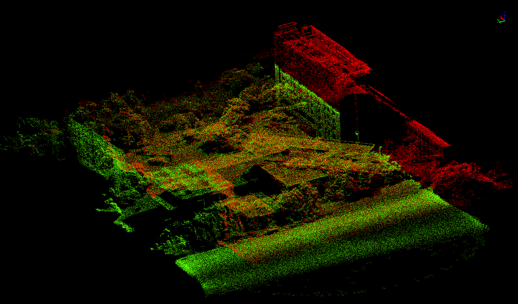
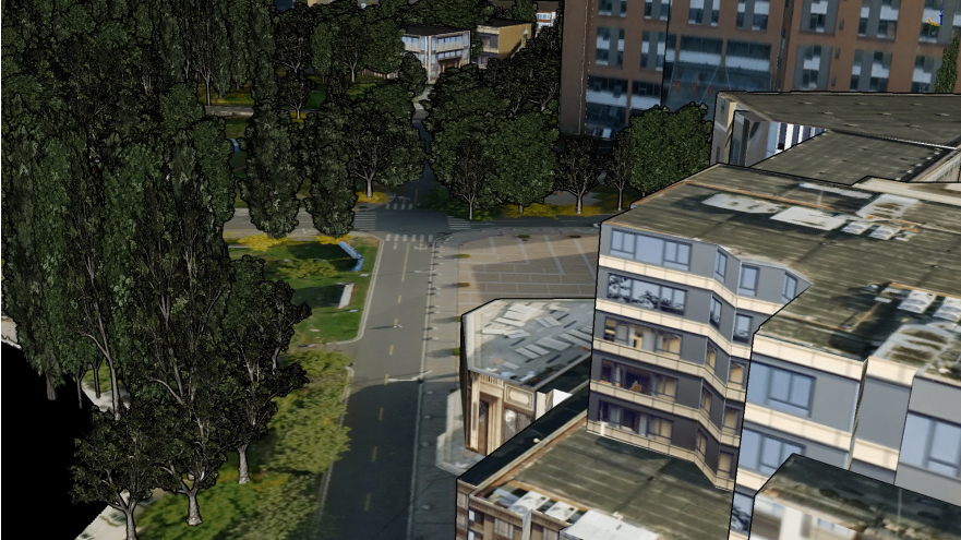
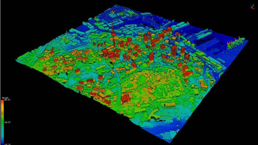
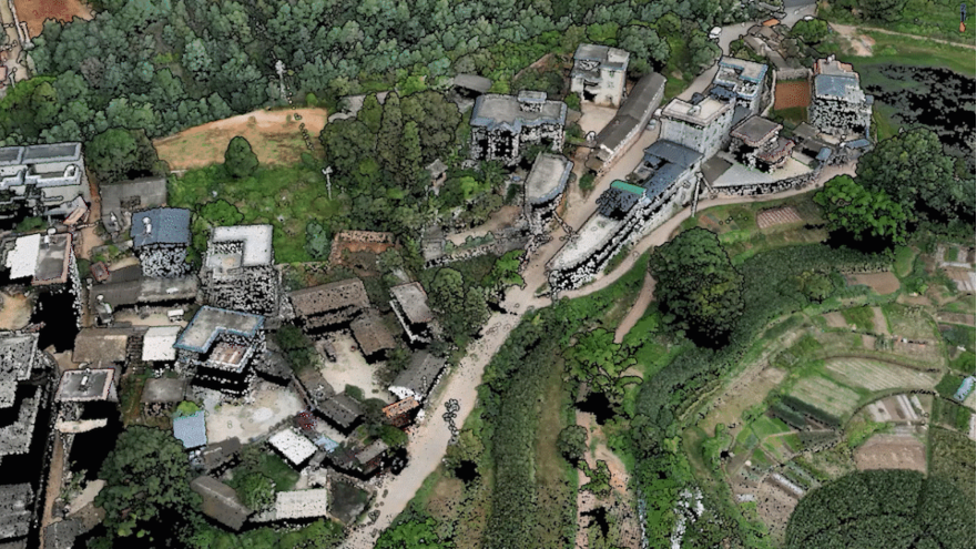
Digital Twins and 3D Real Scene
LiDAR360 ใช้อัลกอริทึมอัจฉริยะในการแยกฉากภูมิประเทศและฟีเจอร์ แยกและสร้างโมเดลพืชพรรณและอาคารแบบชิ้นเดียว เพื่อฟื้นฟูฉากภูมิศาสตร์และสำเนาเชิงกายภาพในระดับเมือง ช่วยสนับสนุนการก่อสร้าง 3 มิติในโลกจริง
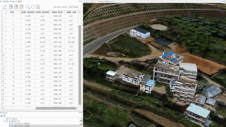
Building Module
Download Brochure
ดาวน์โหลดกรอกแบบฟอร์มขอใบเสนอราคา
หรือโทรปรึกษาเราได้ฟรี ไม่มีค่าใช้จ่าย โทร. 084-682-1041 (ฝ่ายขาย)
ขอใบเสนอราคา