


PIX4Dmatic
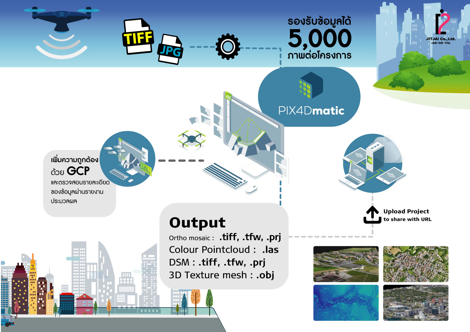
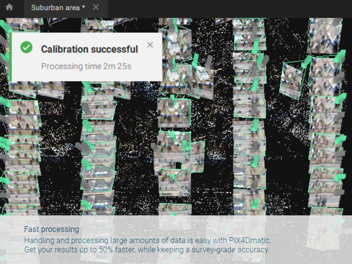
โปรแกรม PIX4Dmatic ประมวลผลภาพหลายพันภาพและยังคงให้ความแม่นยำระดับ survey grade ซึ่งช่วยลดเวลาการในการประมวลผลลงครึ่งหนึ่งจากโปรแกรม สามารถใช้งานได้ง่าย
รองรับข้อมูล
- Aerial (nadir & oblique)
- Terrestrial imagery
- รองรับกล้องทุกรุ่น (compact, SLR,multispectral, GoPro) ในรูปแบบไฟล์ .jpg หรือ .tif
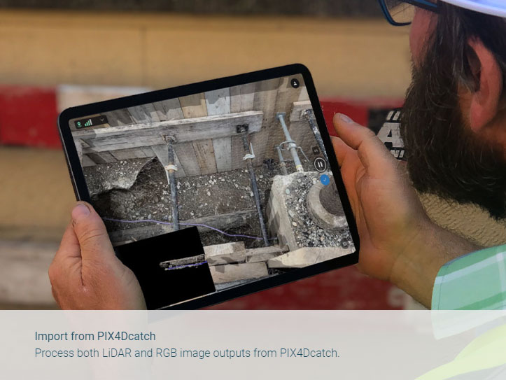
- ข้อมูล Lidar , RGB Image from PIX4Dcatch
PIX4Dmatic
คุณสมบัติของตัวโปรแกรม
- • ตัวโปรแกรมเป็นแบบ Floating license สามารถติดตั้งได้หลายเครื่องคอมพิวเตอร์แต่จะสามารถล็อคอินเข้าใช้งานได้ทีละ 1 เครื่อง
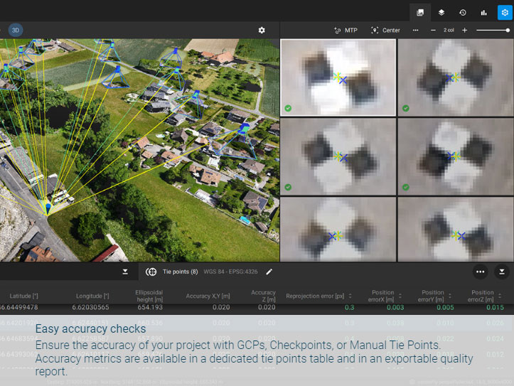
- • สามารถนำเข้า Ground Control Point เพื่อเพิ่มความถูกต้องทางตำแหน่งและนำเข้าจุด Check Point เพื่อตรวจสอบความถูกต้องของผลลัพธ์ ในรูปแบบ .csv/.txt ได้
- • ตัวโปรแกรมมีฟังก์ชั่น AutoGCP สำหรับตรวจจับเป้าและ mark GCP ให้แบบอัตโนมัติ
- • สร้างข้อมูล Point Cloud และสามารถส่งออกในรูปแบบ .laz , .las (1.2 and 1.4) ,.xyz ได้
- • สร้างข้อมูล 3D Texture Mesh และสามารถส่งออกในรูปแบบ .obj ,.slpk Cesium 3D Tiles, .laz ได้
- • สร้างข้อมูล Orthomosaic และสามารถส่งออกในรูปแบบ .tiff (GeoTIFF) , .jpg (Georeferenced with .jgw) , .tfw, .prj ได้
- • สามารถสร้างข้อมูลความสูงภูมิประเทศในรูปแบบข้อมูล DSM และส่งออกข้อมูลในรูปแบบ .tiff (GeoTIFF) ,.tfw, .prj8.
- • มีฟังก์ชั่นในการ Classify point clouds เพื่อแก้ไขหรือลบข้อมูลได้
- • มีฟังก์ชั่นในการวัดแบบ Polyline, Polygon
- • สามารถสร้าง VDO ได้
- • สามารถส่งออกโครงการไปทำงานด้าน CAD ต่อที่โปรแกรม PIX4Dsurvey ได้โดยตรง
- • สามารถอัพโหลดผลลัพธ์ไปที่ PIX4Dcloud เพื่อเผยแพร่ผลลัพธ์ได้
Download Brochure
ดาวน์โหลดPIX4Dmatic
Output
Generate high resolution outputs for any project and use case Easily export your digital maps and models to industry-compatible formats for further analysis or reporting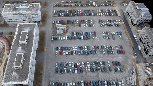
Color point cloud
The color point cloud uses RGB data from a raster for colorization. Each point of the point cloud receives the RGB value of the raster pixel that has the same location.Output formats: .las, .laz, .ply, .xyz
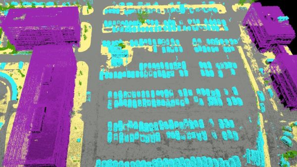
Classified point cloud
The point cloud is classifed in 5 predefined groups: ground, road surface, high vegetation, building, human made object. The results of the classification are used for the DTM generation.Output formats: .las, .laz
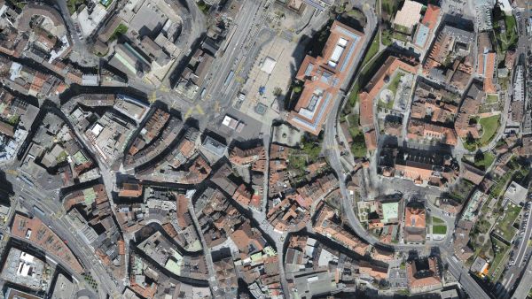
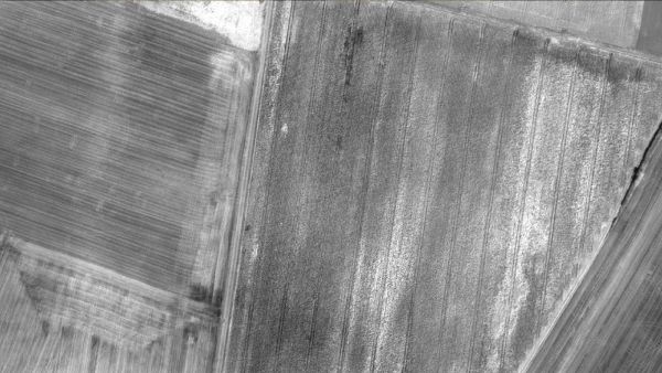
Orthomosaic
2D image map geometrically corrected such that the scale is uniform. Color balanced to be visually pleasing.Output formats: GeoTiff (.tif), .kml
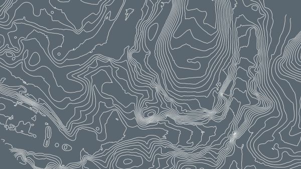
Contour lines
These are lines connecting points of equal elevation. They allow to better understand the shape of the land surface (the topography) on a map.Output formats: .shp, .dxf, .pdf
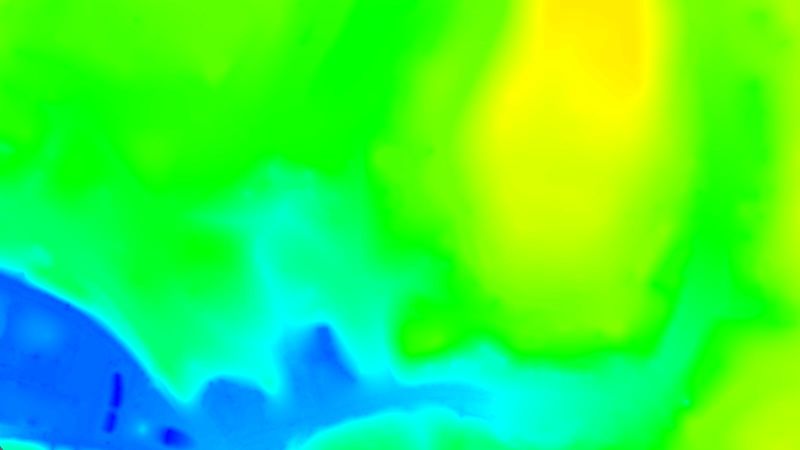
Digital terrain model (DTM)
Digital elevation model (DEM)
2.5 D model of the mapped area after filtering out objects such as buildings, that contains (X,Y,Z) information but no color information.
Output formats: GeoTiff (.tif)
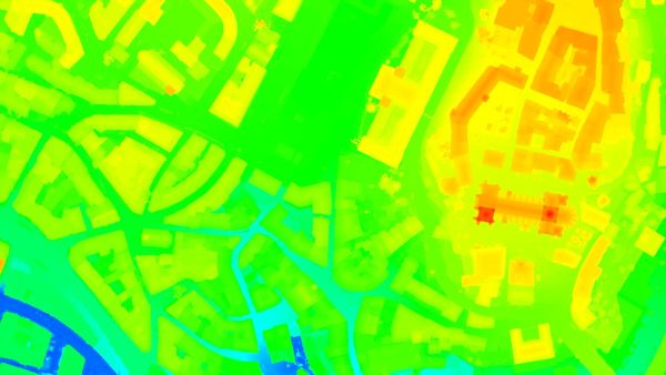
Digital surface model (DSM)
2.5 D model of the mapped area that contains (X,Y,Z) information, but no color information.Output formats: GeoTiff (.tif), .xyz, .las, .laz
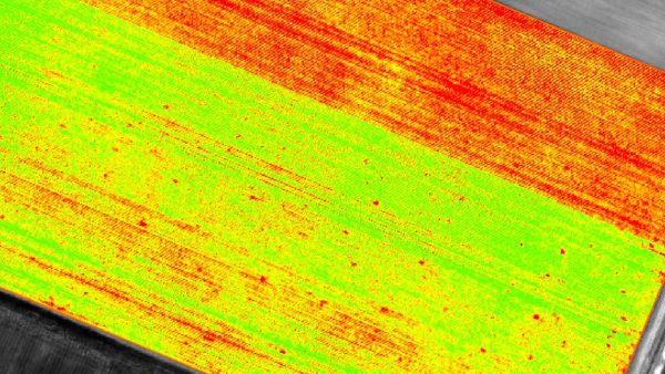
Index maps
Each index is associated to an index map. For each pixel on this map, the value of the pixel is derived from the associated reflectance maps.Output formats: GeoTiff (.tif), .shp
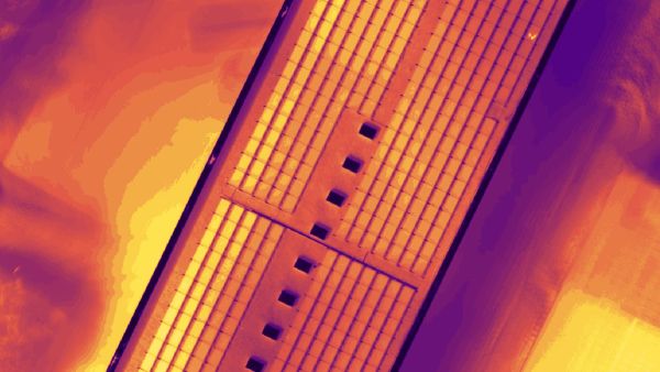
Thermal maps
Thermal maps are 2D maps displaying the thermal information from infrared imaging cameras for each pixel.Output formats: GeoTiff (.tif)
Reflectance maps
A reflectance map compiles the reflectance values of each pixel and geometry into a single function.Output formats: GeoTiff (.tif)
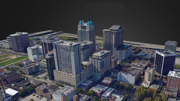
3D textured mesh
A representation of the shape of the model that consists of vertices, edges, faces and the texture from the images that is projected on it..Output formats: .ply, .fbx, .dxf, .obj, .pdf
GET SPECIAL OFFER !!!
รับราคาพิเศษ สำหรับ License แบบซื้อขาดและแบบรายปี กรอกแบบฟอร์มเพื่อขอใบเสนอราคาได้เลย
ขอใบเสนอราคาพิเศษ