


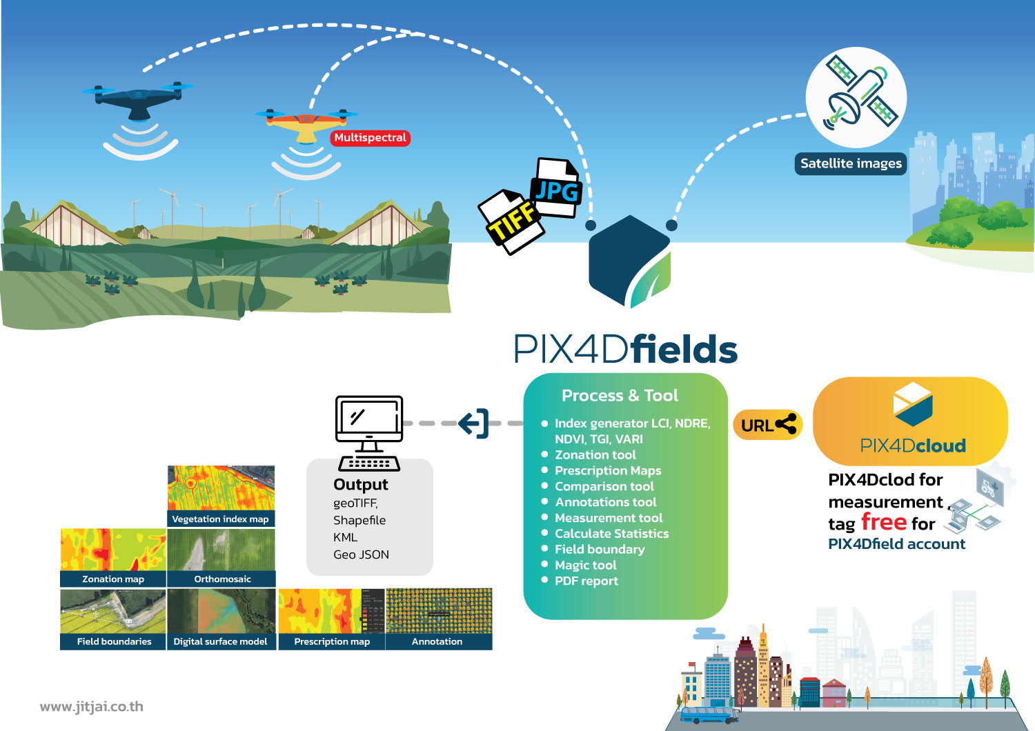
PIX4Dfields
ซอฟต์แวร์การทำแผนที่เกษตรขั้นสูงสำหรับการวิเคราะห์พืชทางอากาศและการเกษตรดิจิตอล
กระบวนการทำงาน
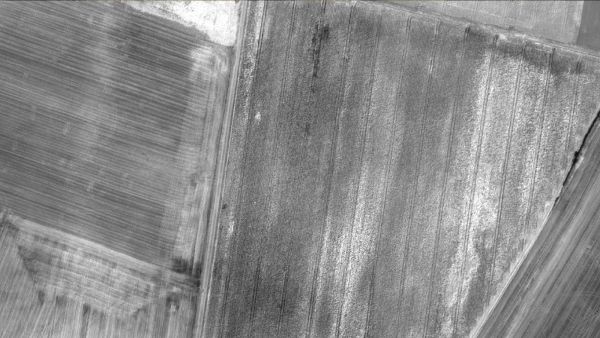
- Remote sensing : รวบรวมรูปภาพโดยใช้โดรนและกล้อถ่ายภาพ RGB หรือกล้องจับภาพความร้อน (Multispectal) รวมถึงใช้การนำเข้าข้อมูลดาวเทียมเพื่อเพิ่มประสบการณ์การทำแผนที่ของคุณด้วยข้อมูลดาวเทียม Sentinel-2
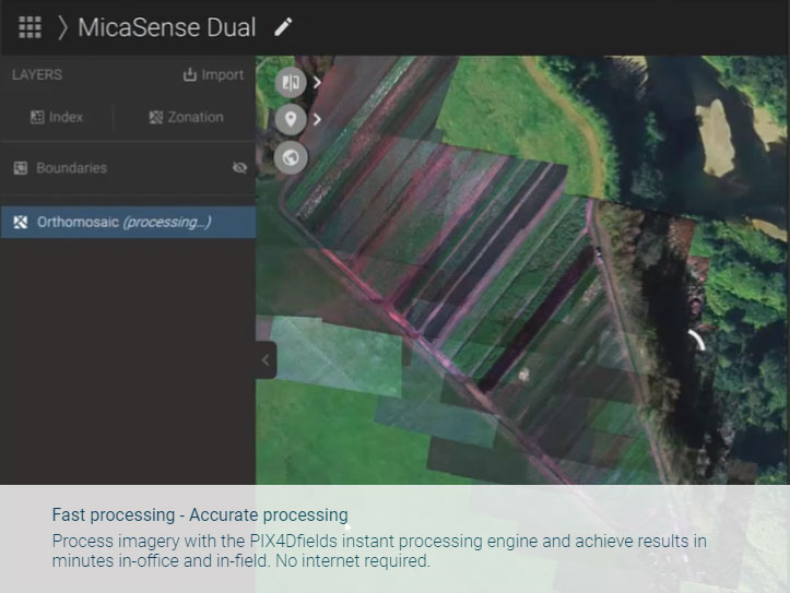
- Process : ประมวลผลภาพด้วยแบบอัตโนมัติทันทีและได้แผนทั้งหมดของคุณโดยตรงที่หน้างาน : เช่น ข้อมูลขนาด 6.8 GB, จำนวน 2948 รูปภาพ, ใช้เวลาเพียง 10 นาที
- Scout : สร้างแผนที่ orthomosaics ที่แม่นยำ, โมเดลพื้นผิวแบบดิจิตอล, แผนที่ดัชนีพันธุ์พืช, โซน และแผนที่สั่งยาที่แม่นยำ กำหนดขอบเขตพื้นที่เป้าหมายของคุณเพื่อสร้างผลลัพธ์ที่เป้าหมายมากขึ้น
- Analyze : มองเห็นและเข้าใจระยะเวลาการเจริญเติบโตของพืชและระดับความสมบูรณ์ วิเคราะห์และเปรียบเทียบข้อมูลชั้นต่าง ๆ ของพื้นผิว เพื่อให้ความเข้าใจทั้งหมดของประสิทธิภาพผลผลิตของคุณและนำมาใช้เพื่อเพิ่มผลผลิตของพืชและลดค่าใช้จ่าย
- Share : แบ่งปันแผนที่ของคุณกับผู้ที่เกี่ยวข้องในโครงการทั้งหมด แบบไร้ขีดจำกัดในการทำงานร่วมกันโดยใช้เครื่องมือรายงาน PDF หรือใช้คำสั่ง Share to PIX4Dcloud
- Integrate : ดาวน์โหลดผลลัพธ์ทั้งหมด, ผลลัพธ์และความรู้และนำเข้าในซอฟต์แวร์การจัดการเกษตรที่คุณเลือกในรูปแบบมาตรฐานของอุตสาหกรรมที่หลากหลาย
PIX4Dfields
ตรวจสอบ วิเคราะห์ และแสดงผลการเปลี่ยนแปลงของพืชของคุณตลอดทั้งปี
- • ประมวลผลอย่างรวดเร็ว - ประมวลผลที่แม่นยำประมวลผลภาพด้วยเครื่องประมวลผลทันทีของ PIX4Dfields และได้ผลลัพธ์ภายในไม่กี่นาทีทั้งในสำนักงานและในที่นา ไม่ต้องการอินเทอร์เน็ต
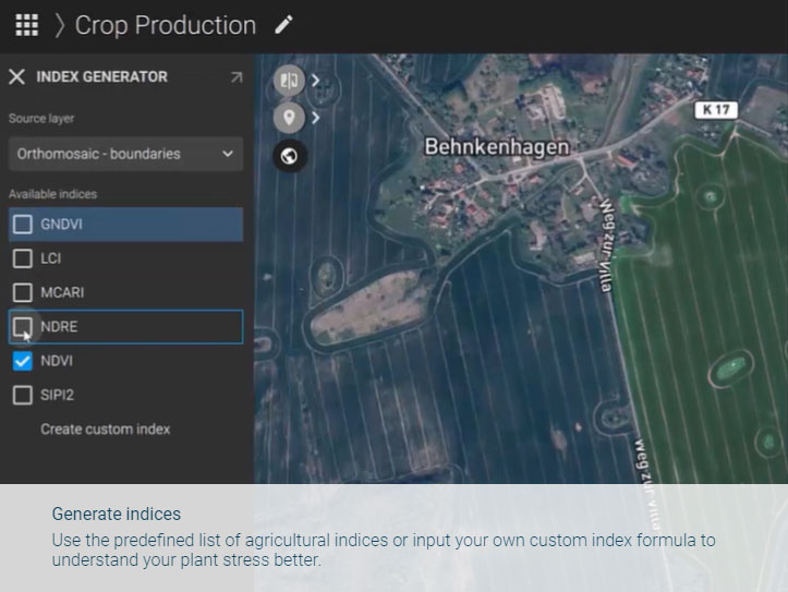
- • สร้างดัชนีใช้รายการที่กำหนดไว้ของดัชนีทางการเกษตรหรือใส่สูตรดัชนีที่กำหนดเองเพื่อเข้าใจการเคลื่อนไหวของพืชของคุณได้ดีขึ้น
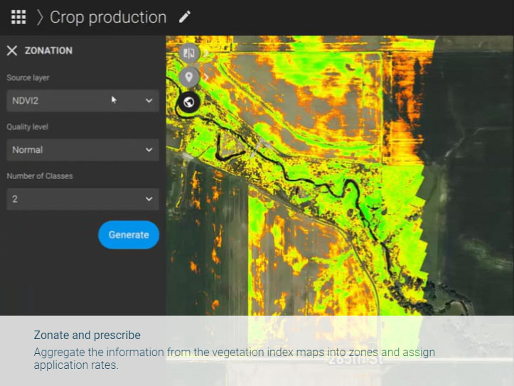
- • แบ่งโซนและจ่ายสารพัดสู่ข้อมูลจากแผนที่ดัชนีพืชลงในโซนและกำหนดอัตราการใช้
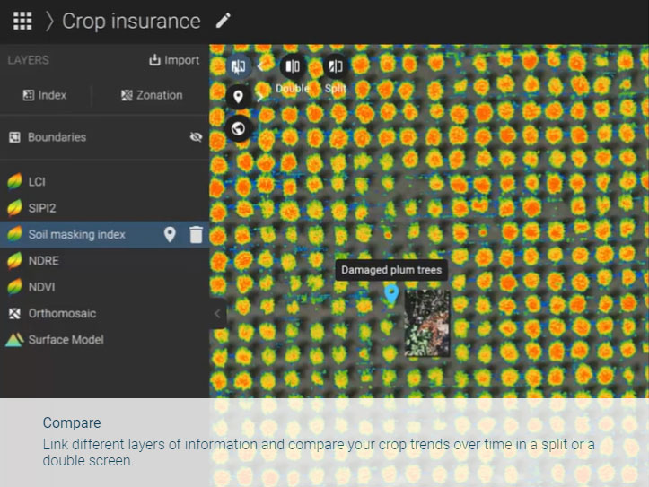
- • เปรียบเทียบเชื่อมโยงชั้นข้อมูลที่แตกต่างกันและเปรียบเทียบแนวโน้มของพืชของคุณตลอดเวลาในหน้าจอแบบแยกหรือหน้าจอแบบคู่
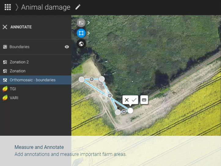
- • วัดและทำเครื่องหมายเพิ่มหมายเหตุและวัดพื้นที่ที่สำคัญในฟาร์ม
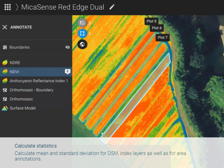
- • คำนวณสถิติคำนวณค่าเฉลี่ยและค่าเบี่ยงเบนมาตรฐานสำหรับ DSM, ชั้นดัชนีรวมทั้งสำหรับหมายเหตุพื้นที่
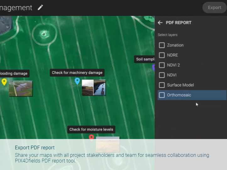
- • ส่งออกรายงาน PDF แบ่งปันแผนที่ของคุณกับผู้ที่เกี่ยวข้องในโครงการทั้งหมดและทีมของคุณให้สามารถร่วมมือได้อย่างไม่มีช่องว่างในการใช้เครื่องมือรายงาน PDF ของ PIX4Dfields.
การใช้ PIX4Dfield
Download Brochure
ดาวน์โหลดPIX4Dfield
Output
สร้างผลลัพธ์ความละเอียดสูงสำหรับทุกโปรเจกต์และทุกการใช้งาน สามารถส่งออกแผนที่และโมเดลดิจิทัลของคุณไปยังฟอร์แมตที่รองรับในอุตสาหกรรมได้อย่างง่ายดาย เพื่อนำไปวิเคราะห์หรือจัดทำรายงานต่อได้อย่างสะดวก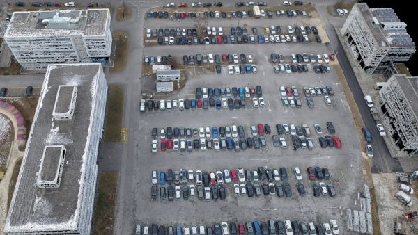
Color point cloud
พอยต์คลาวด์แบบมีสี (Color Point Cloud) ใช้ข้อมูล RGB จากภาพราสเตอร์เพื่อกำหนดสีให้กับแต่ละจุด โดยแต่ละจุดในพอยต์คลาวด์จะได้รับค่าสี RGB จากพิกเซลของราสเตอร์ที่มีตำแหน่งตรงกันOutput formats: .las, .laz, .ply, .xyz
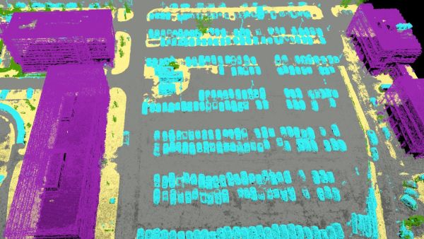
Classified point cloud
พอยต์คลาวด์ถูกจัดประเภทออกเป็น 5 กลุ่มหลัก ได้แก่ พื้นดิน (Ground), พื้นผิวถนน (Road Surface), พืชพรรณสูง (High Vegetation), อาคาร (Building) และวัตถุที่มนุษย์สร้างขึ้น (Human-made Object) โดยผลลัพธ์จากการจำแนกประเภทนี้จะถูกนำไปใช้ในการสร้างแบบจำลองภูมิประเทศ (DTM)Output formats: .las, .laz
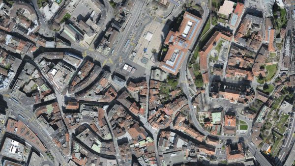
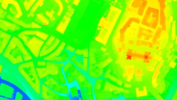
Orthomosaic
แผนที่ภาพ 2 มิติ (2D Image Map) ที่ผ่านการปรับแก้เชิงเรขาคณิต (Geometric Correction) เพื่อให้มีมาตราส่วนสม่ำเสมอทั่วทั้งภาพ พร้อมปรับสมดุลสี (Color Balance) เพื่อให้ภาพดูสวยงามและเหมาะสมต่อการใช้งานOutput formats: GeoTiff (.tif), .kml
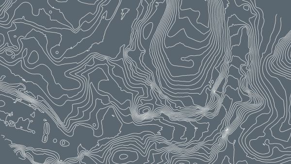
Contour lines
เส้นเหล่านี้คือเส้นที่เชื่อมต่อจุดที่มีค่าระดับความสูงเท่ากัน (Contour Lines) ซึ่งช่วยให้สามารถเข้าใจลักษณะของพื้นผิวภูมิประเทศ (Topography) บนแผนที่ได้ชัดเจนยิ่งขึ้นOutput formats: .shp, .dxf, .pdf
Digital terrain model (DTM)
Digital elevation model (DEM)
โมเดลแบบ 2.5D ของพื้นที่ที่ทำแผนที่ หลังจากกรองวัตถุ เช่น อาคาร ออกแล้ว โดยประกอบด้วยข้อมูลพิกัด (X, Y, Z) แต่ไม่มีข้อมูลสี
Output formats: GeoTiff (.tif)
Digital surface model (DSM)
โมเดลแบบ 2.5D ของพื้นที่ที่ทำแผนที่ ซึ่งประกอบด้วยข้อมูลพิกัด (X, Y, Z) แต่ไม่มีข้อมูลสีOutput formats: GeoTiff (.tif), .xyz, .las, .laz
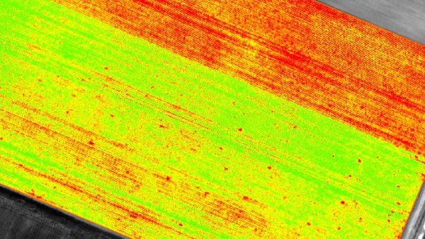
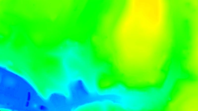
Index maps
แต่ละดัชนี (Index) จะเชื่อมโยงกับแผนที่ดัชนี (Index Map) โดยในแต่ละพิกเซลของแผนที่นี้ ค่าที่ได้จะถูกคำนวณมาจากข้อมูล Reflectance ที่เกี่ยวข้องOutput formats: GeoTiff (.tif), .shp
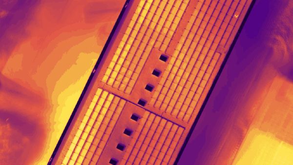
Thermal maps
แผนที่ความร้อน (Thermal Maps) คือแผนที่แบบ 2 มิติ ที่แสดงข้อมูลอุณหภูมิจากกล้องอินฟราเรดในแต่ละพิกเซลOutput formats: GeoTiff (.tif)
Reflectance maps
แผนที่รีเฟลกแตนซ์ (Reflectance Map) คือการรวมค่าการสะท้อนแสงของแต่ละพิกเซลเข้ากับข้อมูลเชิงเรขาคณิตไว้ในฟังก์ชันเดียวOutput formats: GeoTiff (.tif)
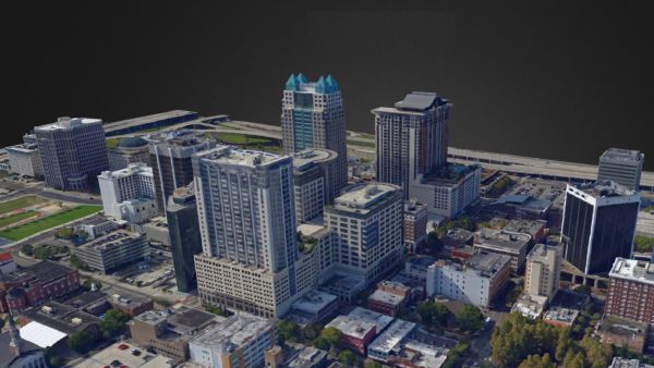
3D textured mesh
การแสดงรูปทรงของโมเดลที่ประกอบด้วยจุดยอด (Vertices), เส้นเชื่อม (Edges), พื้นผิว (Faces) และพื้นผิวลวดลาย (Texture) จากภาพที่ถูกฉายลงบนโมเดลOutput formats: .ply, .fbx, .dxf, .obj, .pdf
GET SPECIAL OFFER !!!
รับราคาพิเศษ สำหรับ License แบบซื้อขาดและแบบรายปี กรอกแบบฟอร์มเพื่อขอใบเสนอราคาได้เลย
ขอใบเสนอราคาพิเศษ