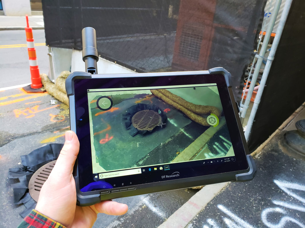
Dot3D for Windows & Android
Accurate 3D scanning from Windows & Android
- • Instant, mobile 3D scanning of rooms, spaces, equipment, and more)
- • Highly accurate point cloud data sets comparable to and compatible with larger scale 3D scanning devices (terrestrial, aerial, mobile mapping)
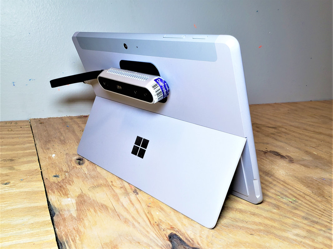
- • Large scene capture (up to 160 million points) with compatible hardware
- • Advanced targeting and optimization capabilities for highly accurate results
- • All local processing! No internet connectivity or cloud computing required
Download Brochure Dot3D for Windows & Android
ดาวน์โหลด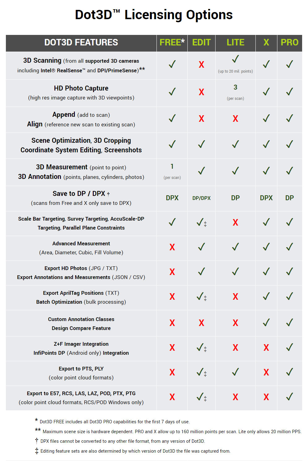
Core features:
The complete professional 3D laser scanning application for all iOS devices equipped with built-in LiDAR Instant, accurate 3D laser scanning directly from your iPhone or iPad Pro! Generate powerfully precise results for engineering, real estate, public safety, utilities, MEP, shipbuilding, and more.
- Real-time 3D reconstruction with live quality feedback
- Local data optimization (post-processing) for highly accurate results
- Automatic AprilTag targeting for intelligent accuracy improvement
- Planarity constraints, HD photo capture, and scan-time annotation
- Single scene capture of up to 160 million points for larger spaces
- Optional targeting workflows to reference known measurements / coordinates
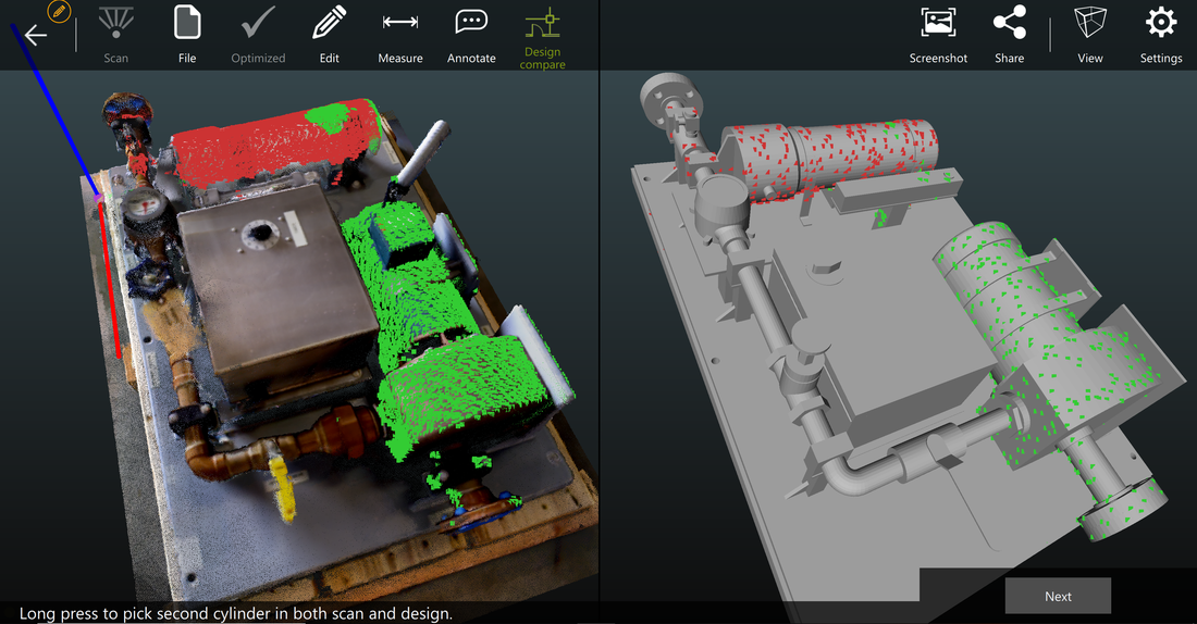
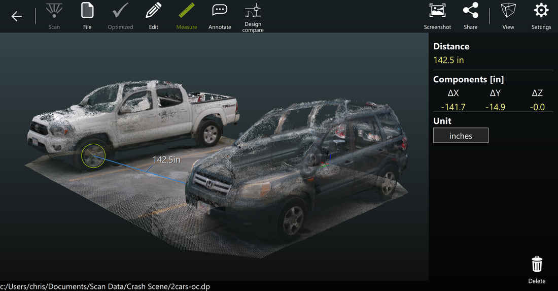
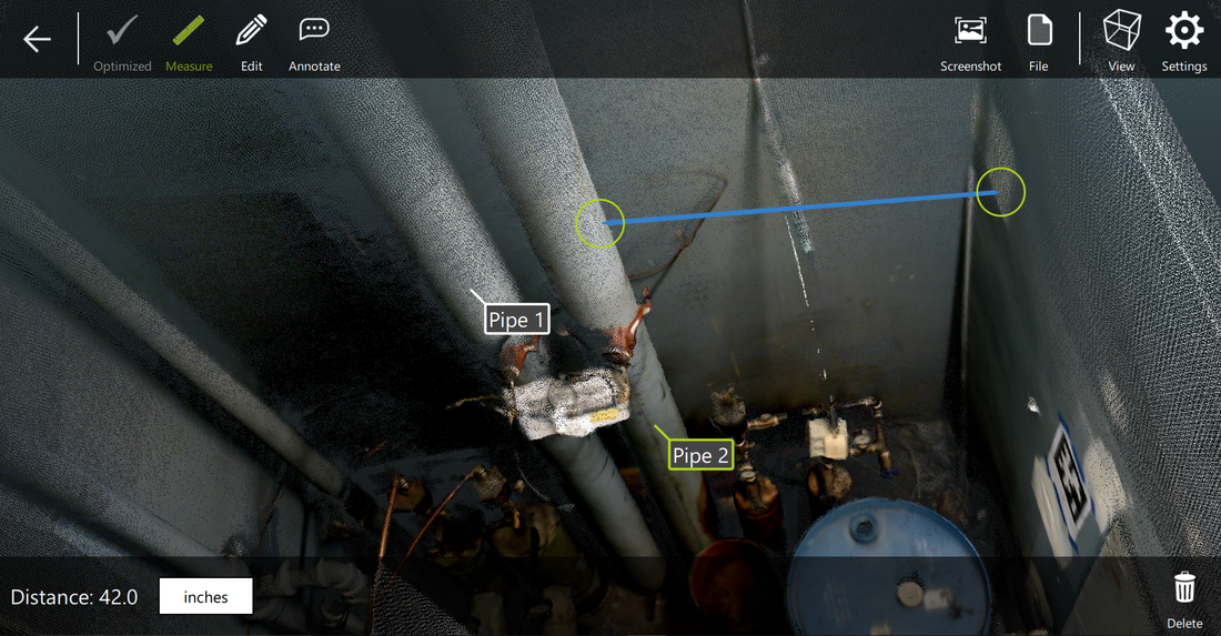
- Precise, savable measurements of distance, area, volume, and more
- Convenient 3D editing with cropping, filtering, and coordinate system management
- Direct color 3D point cloud export: DP, E57, RCS, LAS, LAZ, PTS, PTX, PLY, PTG, POD (RCS & POD Windows only)
Dot Product
Relate Video
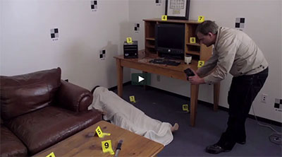
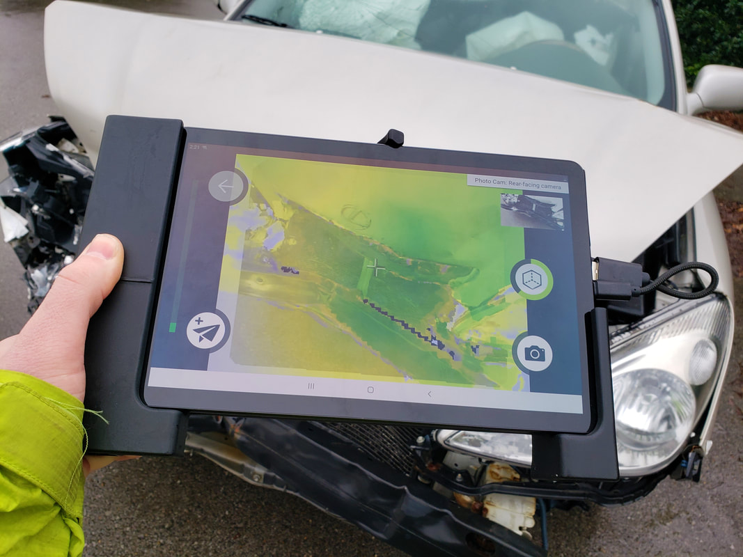
FORENSICS & CRIME SCENE
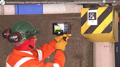
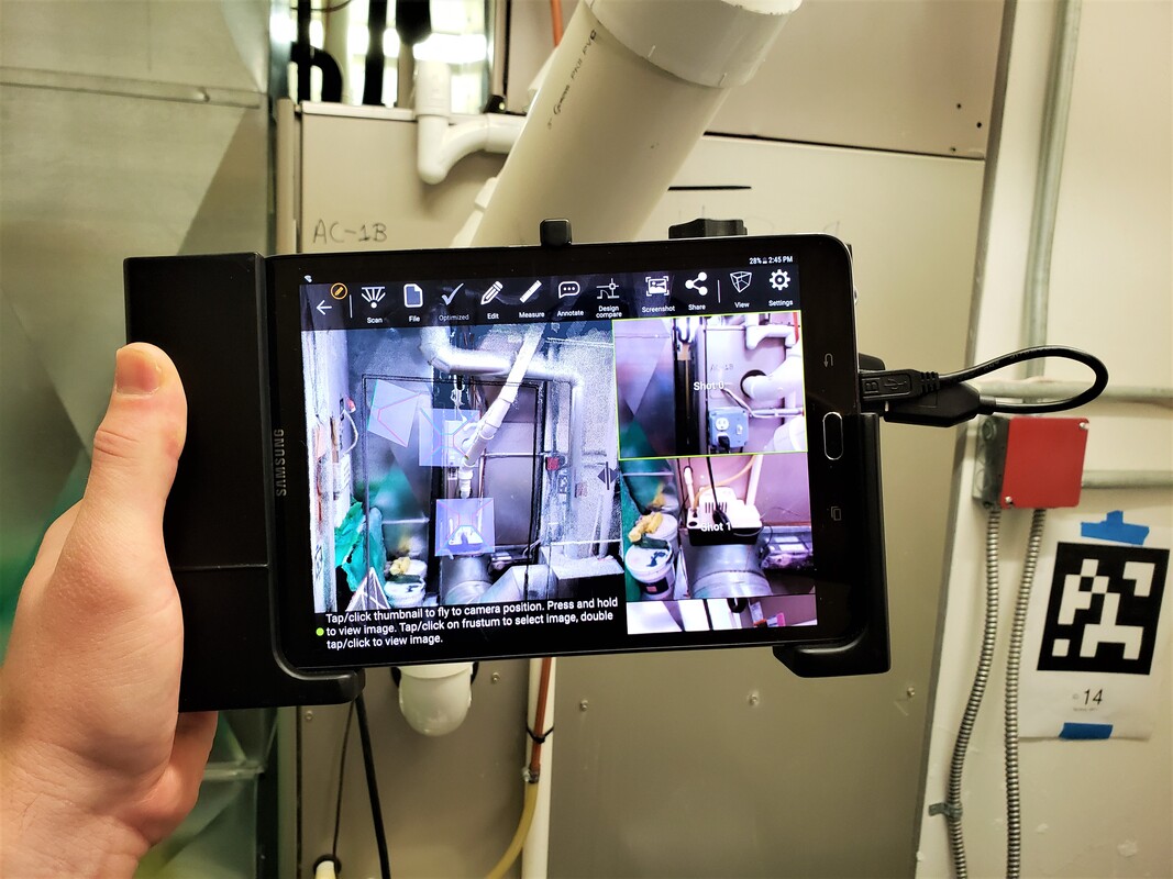
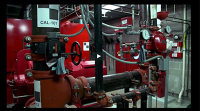
INDUSTRIAL, ENGINEERING, & CONSTRUCTION
MARINE: SHIPBUILDING & OFFSHORE OIL ENGINEERING
REVERSE ENGINEERING & 3D PRODUCT DESIGN
Outdoor 3D Scanning with Intel® RealSense™
Survey Targeting with Checkerboard Targets
Registering Multiple DP Scans with AprilTags in Dot3D Pro
