Orbit Feature Extraction
THE TOOLS FOR A PROFESSIONAL 3D MAPPING BUSINESS
เป็นโปรแกรมวิเคราะห์ข้อมูล สำหรับหา
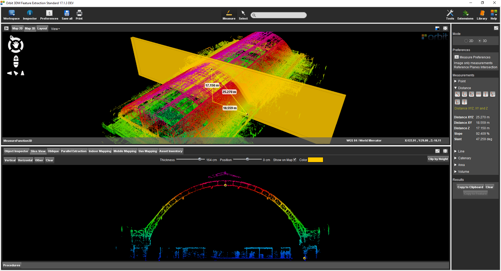
- Profile Cross section
- volume , clash detection
- จัดทำ asset inventory
- digitize ข้อมูลในรูปแบบ 3 มิติ
- จัดทำโมเดล 3 มิติ
- vector overlay
Download Brochure
ดาวน์โหลดOrbit Feature Extraction
Feature
PROFESSIONAL FEATURE EXTRACTION UNIT
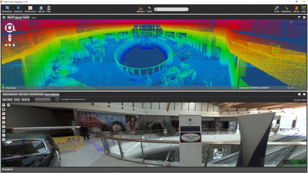
The 3DM Feature Extraction product has no parallel anywhere in the world: a smart set of displaying and measuring tools combined with a dedicated user interface for every type of 3D mapping data allows every user to browse efficiently through all types and sizes of mobile, indoor, oblique, uas, and terrestrial mapping content in very little time.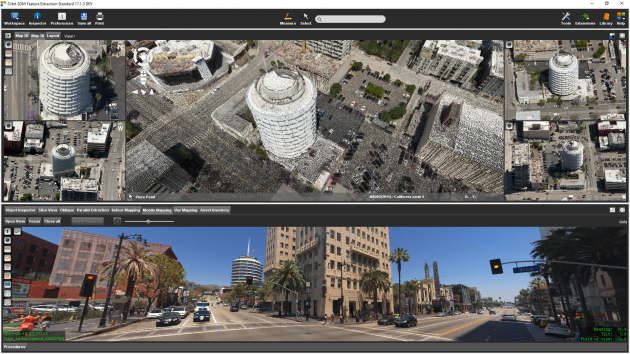
FULL 3D VIEW
Full 3D and image viewing; Play through all images; Overlay any 2D and 3D vector data; Set transparency, view depth, height adjustment of 3D point cloud; Measure in 2D/3D & Imagery; Single click and triangulation measurements; Semi-automated measurements of point, line, area, circle, catenary curve, squared volumes, etc; Extract features and save in GIS/CAD; 3D view in stereo, perspective, and isometric mode; Skyline backdrop on 3D view; 3D movie creator and export.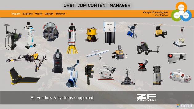
STRONG INDUSTRY SUPPORT
Orbit’s 3D Mapping software supports all known mobile, uas, oblique, and terrestrial mapping hardware systems, translating different device setups and specifications into a single user-friendly environment. With templates tuned to each vehicle setup, Orbit’s products make import very simple.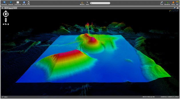
ANALYSE & REPORT VOLUMES, PROFILES, CONTOURS, CROSS SECTIONS, CLASHES
Process cross-sections along your trajectory or create a profile along a 3D path. Calculate and analyze volumes over time. Detect clashes using an imported or designed shape. Get your optimal Slice View for in-depth analyses. Generate contour lines within a predefined area. Document & report your results.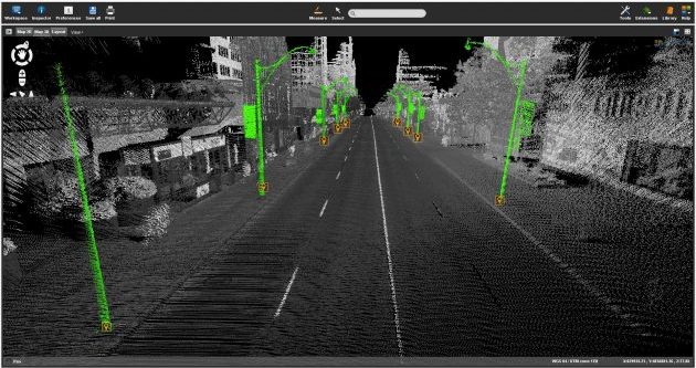
Automatic Detection For Poles, Traffic Signs, Shapes
Along with assisting procedures to define the perfect set of parameters, as well as a complete verification procedure to QC afterward, the 3DM Feature Extraction Pro product comes with full automated detection tools for poles, traffic signs and shapes. Results are stored in your database with all required metadata such as ground position, height, snapshot, the shape of the sign, etc.