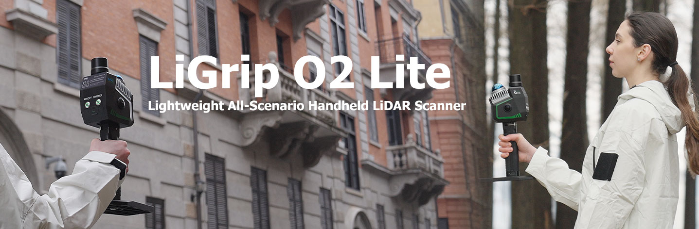
Overview
LiGrip O2 Lite คือผลิตภัณฑ์ SLAM แบบมือถือรุ่นใหม่ล่าสุดจาก GreenValley International (GVI) ที่ใช้เทคโนโลยีระบุตำแหน่งแบบผสานหลายเซ็นเซอร์ MLF-SLAM (Multiple Localization Fusion-SLAM) สามารถก้าวข้ามความท้าทายในการทำแผนที่ในพื้นที่ที่ไร้จุดสังเกต เช่น สนามบิน ชายหาด และแม่น้ำ พร้อมมอบการเก็บข้อมูลในระดับเซนติเมตรได้ในทุกสภาพแวดล้อม
Function
การเก็บข้อมูลในพื้นที่ไร้จุดสังเกต
พัฒนาอย่างล้ำสมัยด้วยอัลกอริทึม MLF-SLAM: ก้าว突破ครั้งสำคัญของอัลกอริทึม LiDAR SLAM ที่สามารถก้าวข้ามข้อจำกัดในการทำแผนที่ในสภาพแวดล้อมที่มีจุดสังเกตน้อยหรือไร้จุดสังเกต (เช่น สนามบิน ชายหาด พื้นที่น้ำ) พร้อมรองรับการเก็บข้อมูลความแม่นยำสูงได้ในทุกสถานการณ์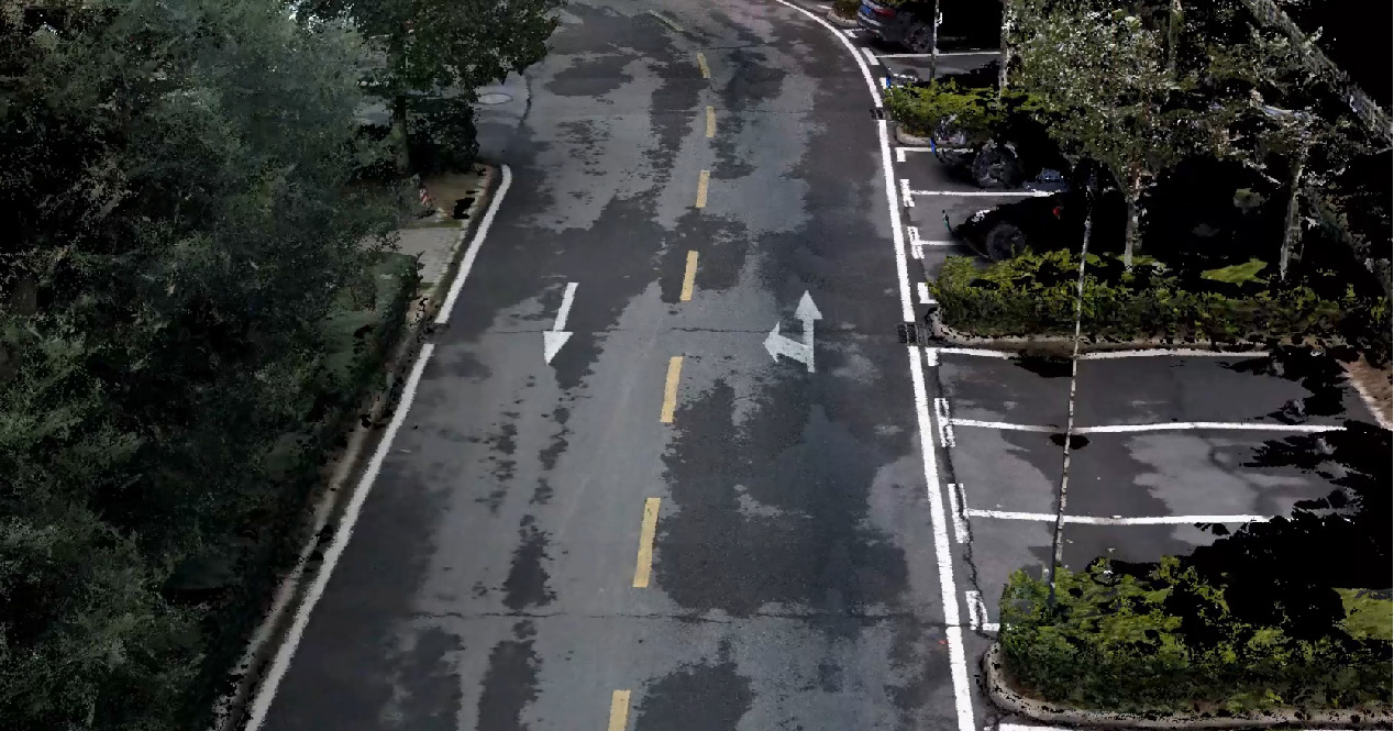
ข้อมูลแม่นยำ ประสิทธิภาพโดดเด่น
กะทัดรัดแต่มากพลัง: ความแม่นยำเชิงสัมบูรณ์ 3 ซม. พอยต์คลาวด์คมชัด พร้อมการจัดแนวในแนวนอนและแนวตั้งที่แม่นยำ รองรับมาตรฐานงานสำรวจ และช่วยทำให้งานสำรวจราบรื่นยิ่งขึ้น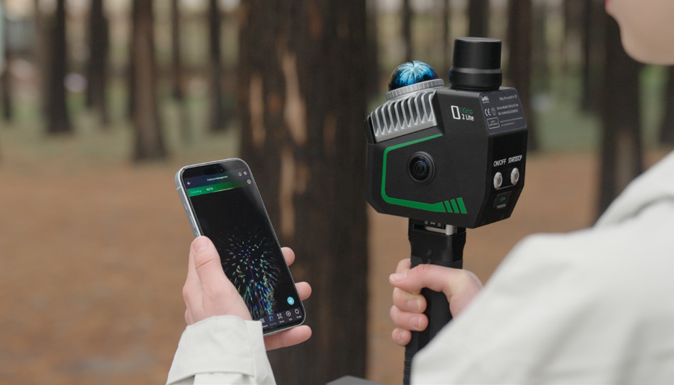
กล้องพาโนรามาความละเอียดสูง + Visual SLAM
กล้องพาโนรามาคู่ 12 MP: การซิงโครไนซ์ระดับไมโครวินาที เพื่อการสร้างฉากที่สมจริงยิ่งขึ้น Visual SLAM (VSLAM) & LiDAR-SLAM Deep Fusion: รองรับการทำแผนที่อย่างแม่นยำในสภาพแวดล้อมที่ซับซ้อน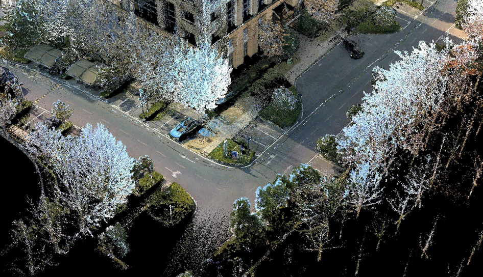
ประมวลผลและใส่สีแบบเรียลไทม์ ส่งออกใช้งานได้ทันที
การทำแผนที่พอยต์คลาวด์สีจริงแบบเรียลไทม์: พร้อมส่งออกทันที รองรับการใช้งานได้หลายรูปแบบ เช่น การคำนวณปริมาณดิน การแยกต้นไม้รายต้น และการทำแผนที่ภูมิประเทศ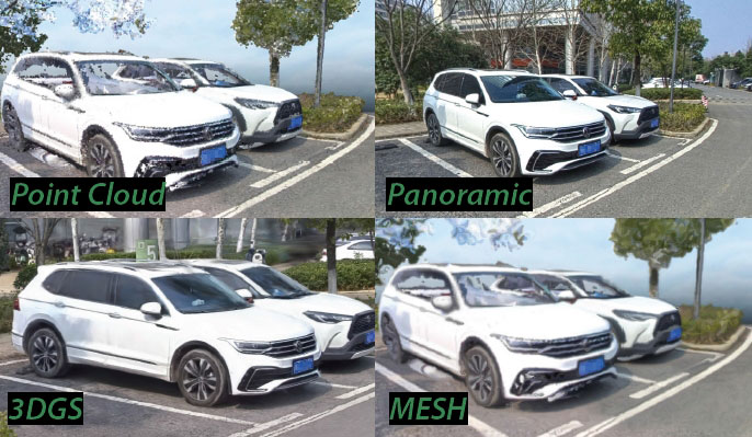
เก็บข้อมูลครั้งเดียว ได้ผลลัพธ์หลายมิติ
โซลูชันแบบบูรณาการสำหรับการเก็บข้อมูลจากหลายแหล่ง: ส่งออกพร้อมกันทั้งพอยต์คลาวด์ 3D, ภาพพาโนรามา, 3DGS, MESH และข้อมูลอื่น ๆ ได้ในการเก็บเพียงครั้งเดียว ก้าวข้ามข้อจำกัดของการทำงานแบบลำดับขั้นดั้งเดิม และเพิ่มประสิทธิภาพด้านต้นทุน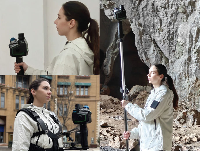
การเก็บข้อมูลได้หลายรูปแบบ
รองรับการเก็บข้อมูลในหลายรูปแบบ: แบบมือถือ แบบสะพายหลัง แบบสะพายหน้า และขาต่อเสายืด เพื่อความยืดหยุ่นในการปรับใช้ให้เหมาะกับทุกสถานการณ์ของลูกค้า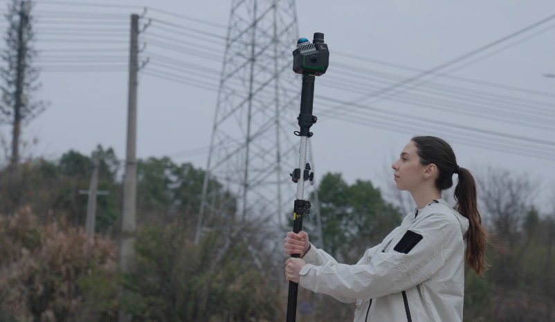
โหมดการเก็บข้อมูลแบบ RTK-SLAM
เทคโนโลยี RTK-SLAM ที่พัฒนาขึ้นเอง: ใช้งานร่วมกับขาต่อเสายืด เพื่อรองรับการเก็บข้อมูล RTK ความแม่นยำสูงครอบคลุมทุกช่วง ด้วยความแม่นยำระดับเซนติเมตรDownload Brochure
ดาวน์โหลดการเก็บข้อมูลได้หลายรูปแบบ
นอกจากการใช้งานแบบมือถือแล้ว ยังรองรับการเก็บข้อมูลได้หลายการกำหนดค่า ทั้งแบบสะพายหลัง แบบสะพายหน้า และขาต่อเสายืด เพื่อความยืดหยุ่นในการปรับใช้ให้เหมาะกับทุกสถานการณ์ของลูกค้า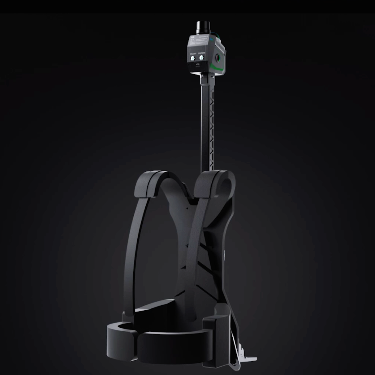
Backpack kit
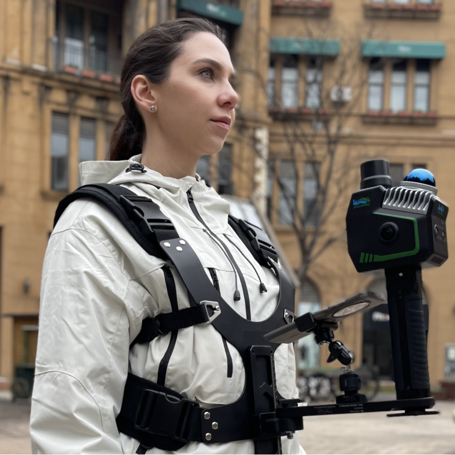
Frontpack Kit
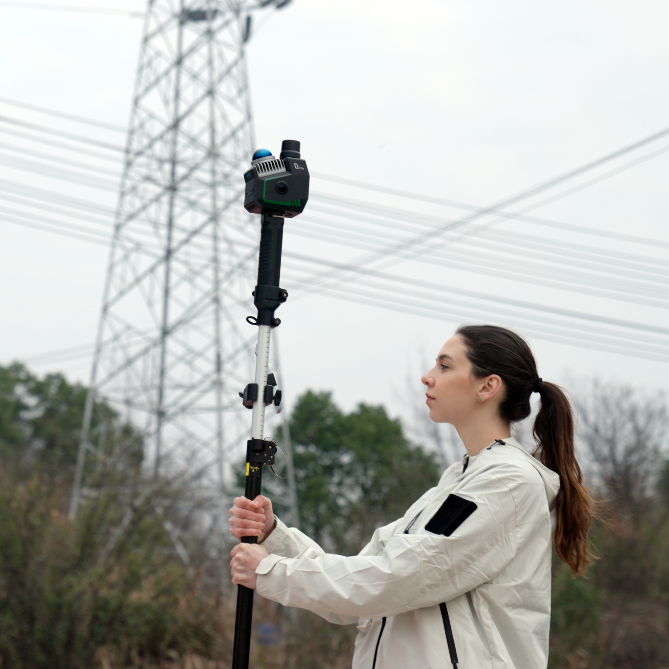
Telescopic Pole
กรอกแบบฟอร์มขอใบเสนอราคา
หรือโทรปรึกษาเราได้ฟรี ไม่มีค่าใช้จ่าย โทร. 084-682-1041 (ฝ่ายขาย)
ขอใบเสนอราคา