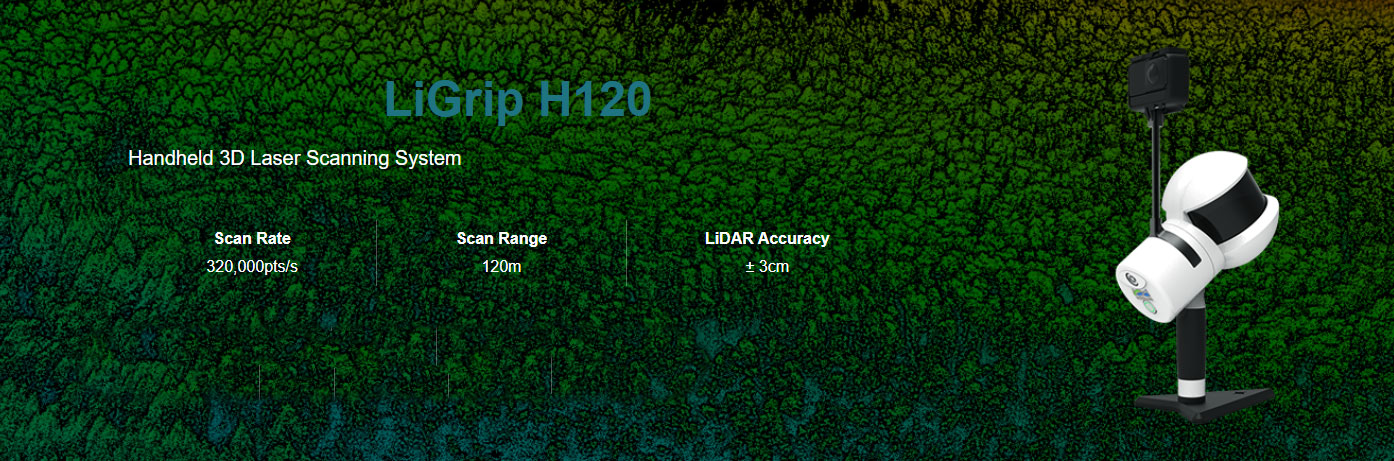
Overview
LiGrip H120 handheld rotating laser scanner is a new series of products launched by GreenValley International. The product adopts a simple style design, compact body, light hand-held, convenient operation and flexible installation; with a variety of sensors, it can quickly capture a wide range of scenes Data; supports multi-platform and multi-mode operations, and combines LiDAR and SLAM algorithms to achieve integrated indoor multi-scene measurement. With GreenValley's self-developed LiFuser-BP point cloud processing software, the point cloud data can be post-processed quickly.
Function
Cutting-edge SLAM Algorithm
Utilizing GreenValley's very own Industry-leading SLAM (Simutaneous Localization And Mapping) algorithm, LiGrip providesreal-time on-the-go accurate positioning as you map your environments.Multi-platform
Supports handheld, backpack, vehicle, and other operating platforms to achieve full coverage of collection requirements in different scenarios, which improves a lot of operation effciencyMulti-modes
Supports two operating modes: mobile WIFI (all-in-one kit) and clientless (pure hand-held built-in) operation, which can be exibly selected according to the operating environmentDownload Brochure
ดาวน์โหลดRecommend Industry
HD MAPS
Map solutions include data acquisition, data fusion, object detection, vectorization, mapping, and so on.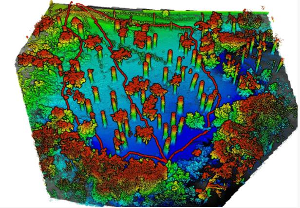
FORESTRY
Leverage LiDAR360 processing software to generate geospatial products from mobile, terrestrial, UAV or airborne systems that meet critical needs of foresters.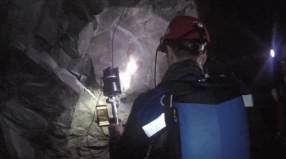
MINING
Solution using GVI LiBackpack DGC50H and LiDAR360 that allow clients to quickly and accurately measure the volume of sand barge cargo load in various and sometimes difficult operating environments.
POWERLINE
Using LiAir Series and LiPowerline to detect hazardous vegetation overgrowth along the transmission lines and pylons.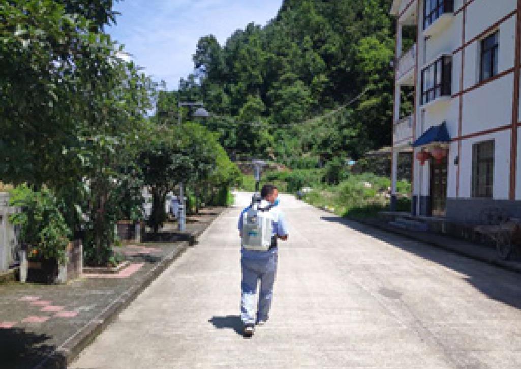
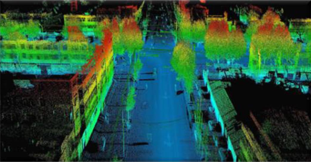
UTILITIES
A previous article showcased GVI solutions using UAV LiDAR for high-voltage transmission line survey. We now turn to another question, what about using LiDAR to inspect power distribution lines in urban neighborhoods?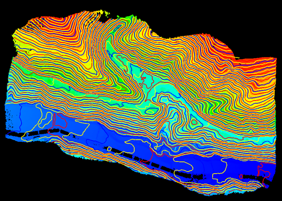
TERRAIN
Data set alignment also referred to as co-registration, can be quickly carried out using LiDAR360 point cloud processing software.Using LiAir Series and LiPowerline to detect hazardous vegetation overgrowth along the transmission lines and pylons.กรอกแบบฟอร์มขอใบเสนอราคา
หรือโทรปรึกษาเราได้ฟรี ไม่มีค่าใช้จ่าย โทร. 084-682-1041 (ฝ่ายขาย)
ขอใบเสนอราคา