


PIX4Dinspect
Automate industrial inspection and asset management with intelligent digital twins
WORK PROCESS
- Capture : Capture your aerial data with PIX4Dcapture Pro, and terrestrial data with PIX4Dcatch.
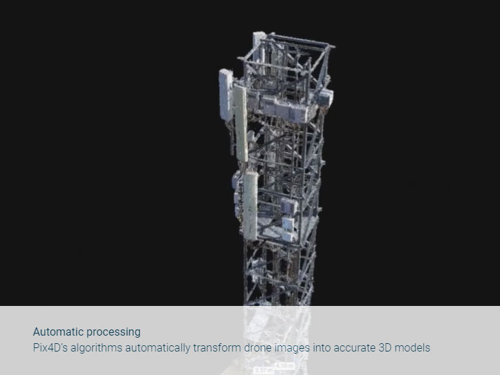
- Process : Upload your drone imagery to PIX4Dinspect and save time with automatic processing. Automatically transform data into accurate and inspection-ready 3D models thanks to the fast upload and native workflow.
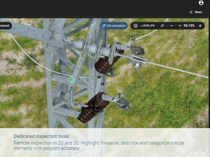
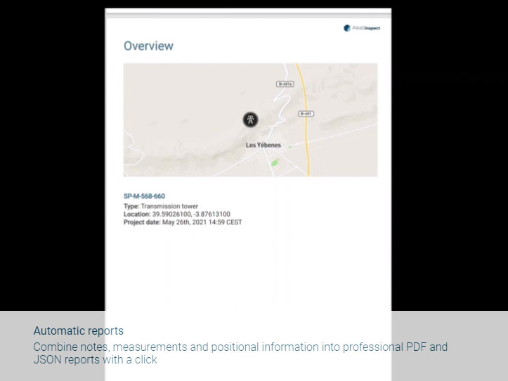
- Report : Inspect your asset with the original images and a detailed model, making annotations and accurate measurements with the help of AI. Save time with automatic reports. PIX4Dinspect records, compiles and formats annotations with positional information as you go. Export your professional report with just a click.
- Store & share : Work with multiple stakeholders and manage large quantities of inspection data in real time, with ease. PIX4Dinspect is cloud-based and always scalable
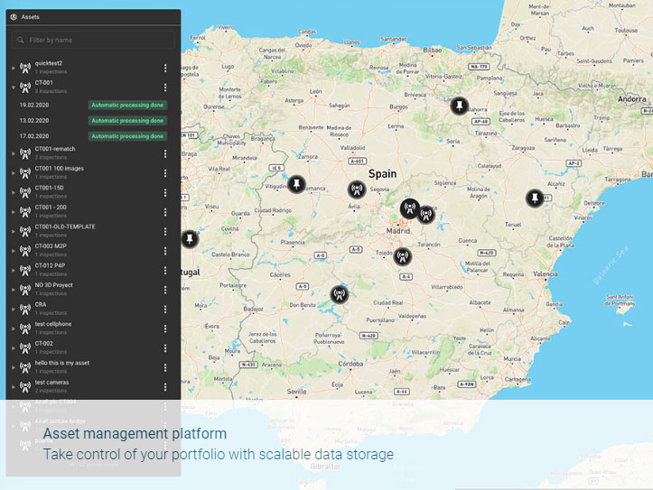
- Manage : Use the map-based Asset Management platform to easily find your assets and linked inspection records. Take control of your company’s entire portfolio and support thorough decisions with historical, highly detailed records.
PIX4Dinspect
An automated solution that can grow with you
- • Automatic processing Pix4D’s algorithms automatically transform drone images into accurate 3D models
- • Dedicated inspection toolsRemote inspection in 2D and 3D. Highlight, measure, describe and categorize critical elements with pinpoint accuracy
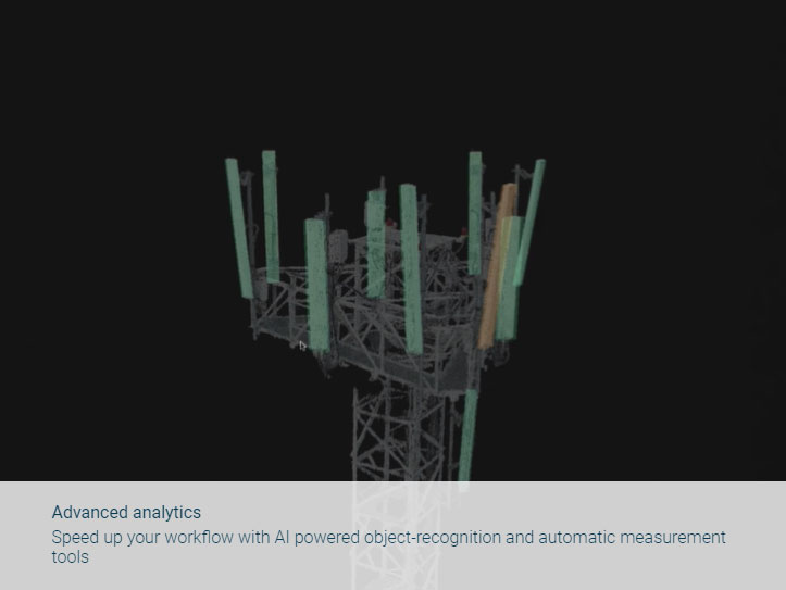
- • Advanced analyticsSpeed up your workflow with AI powered object-recognition and automatic measurement tools
- • Automatic reports Combine notes, measurements and positional information into professional PDF and JSON reports with a click
- • Asset management platformTake control of your portfolio with scalable data storage
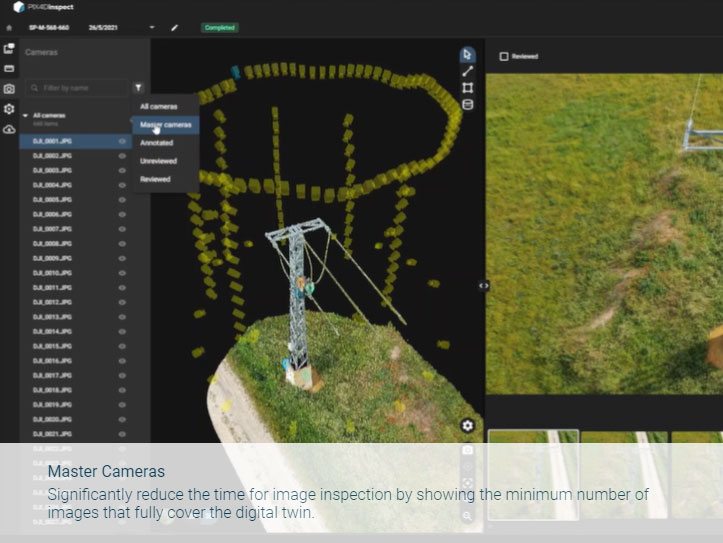
- • Master CamerasSignificantly reduce the time for image inspection by showing the minimum number of images that fully cover the digital twin.
Download Brochure
ดาวน์โหลดPIX4Dcloud
Output
Generate high resolution outputs for any project and use case Easily export your digital maps and models to industry-compatible formats for further analysis or reporting
Color point cloud
The color point cloud uses RGB data from a raster for colorization. Each point of the point cloud receives the RGB value of the raster pixel that has the same location.Output formats: .las, .laz, .ply, .xyz
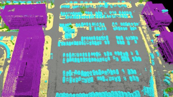
Classified point cloud
The point cloud is classifed in 5 predefined groups: ground, road surface, high vegetation, building, human made object. The results of the classification are used for the DTM generation.Output formats: .las, .laz
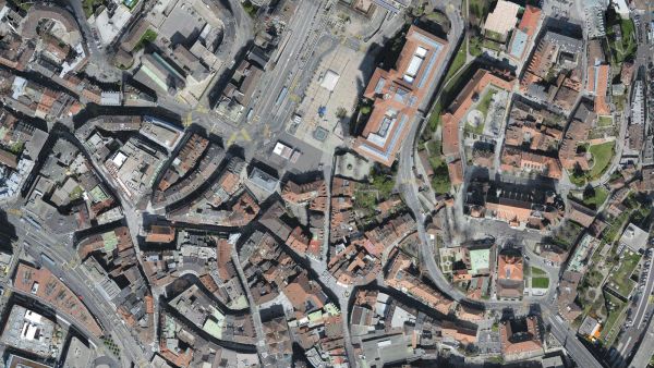
Orthomosaic
2D image map geometrically corrected such that the scale is uniform. Color balanced to be visually pleasing.Output formats: GeoTiff (.tif), .kml
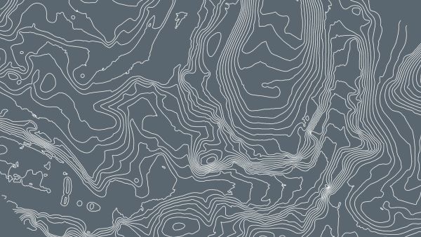
Contour lines
These are lines connecting points of equal elevation. They allow to better understand the shape of the land surface (the topography) on a map.Output formats: .shp, .dxf, .pdf
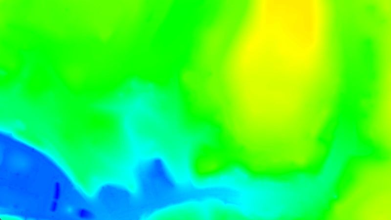
Digital terrain model (DTM)
Digital elevation model (DEM)
2.5 D model of the mapped area after filtering out objects such as buildings, that contains (X,Y,Z) information but no color information.
Output formats: GeoTiff (.tif)
Digital surface model (DSM)
2.5 D model of the mapped area that contains (X,Y,Z) information, but no color information.Output formats: GeoTiff (.tif), .xyz, .las, .laz
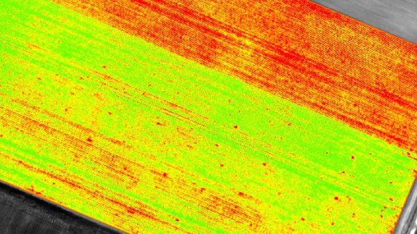
Index maps
Each index is associated to an index map. For each pixel on this map, the value of the pixel is derived from the associated reflectance maps.Output formats: GeoTiff (.tif), .shp
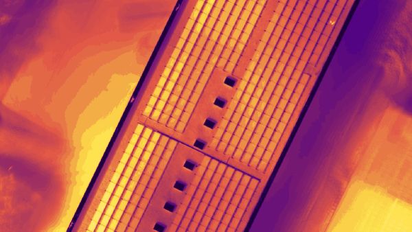
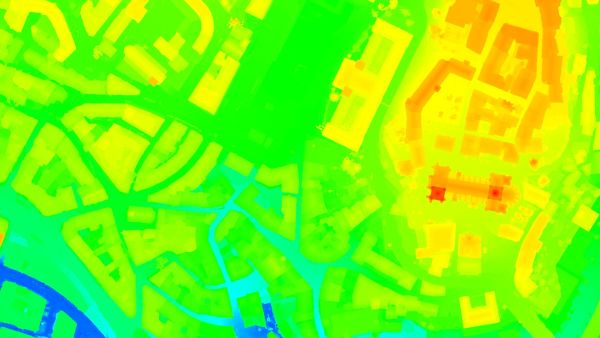
Thermal maps
Thermal maps are 2D maps displaying the thermal information from infrared imaging cameras for each pixel.Output formats: GeoTiff (.tif)
Reflectance maps
A reflectance map compiles the reflectance values of each pixel and geometry into a single function.Output formats: GeoTiff (.tif)

3D textured mesh
A representation of the shape of the model that consists of vertices, edges, faces and the texture from the images that is projected on it..Output formats: .ply, .fbx, .dxf, .obj, .pdf
GET SPECIAL OFFER !!!
รับราคาพิเศษ สำหรับ License แบบซื้อขาดและแบบรายปี กรอกแบบฟอร์มเพื่อขอใบเสนอราคาได้เลย
ขอใบเสนอราคาพิเศษ