


PIX4Dsurvey
Bridge the gap between photogrammetry and CAD
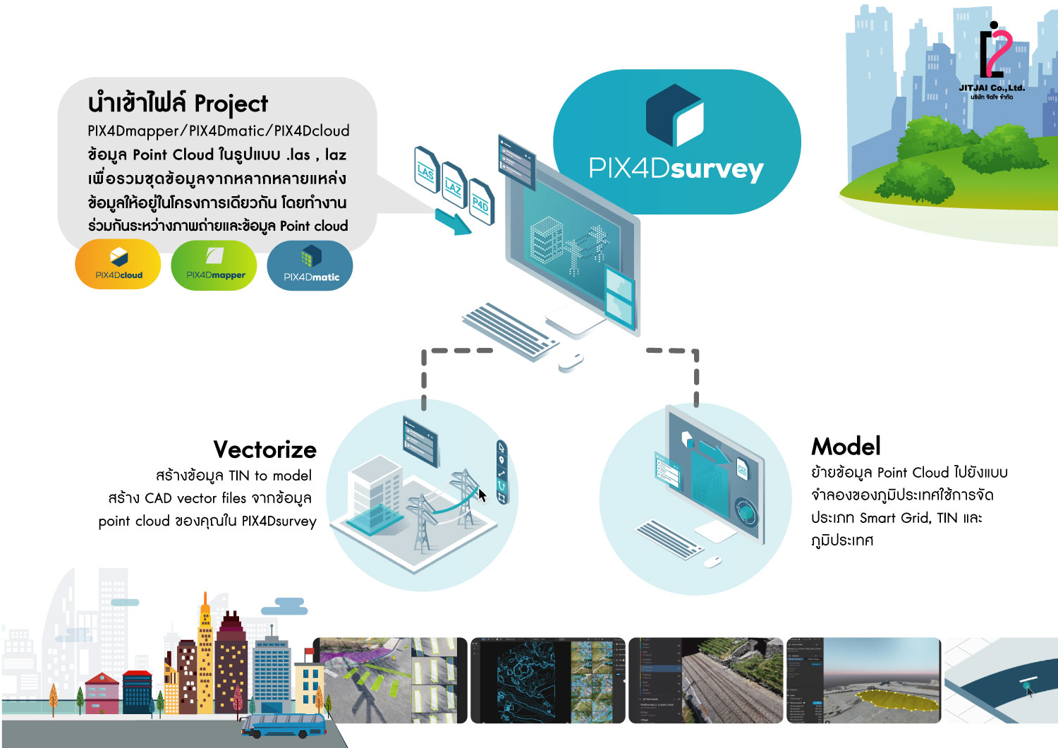
WORK PROCESS
- Capture : Capture images or point clouds with a drone or any laser scanner.When using a drone, automate and optimize your flights with the free PIX4Dcapture mobile app.
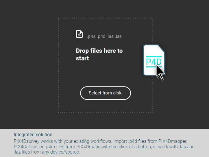
- Import : Import data from other Pix4D software or a .las or .laz file to PIX4Dsurvey and combine multiple datasets into the same project.Work with both imagery data and LiDAR point clouds.
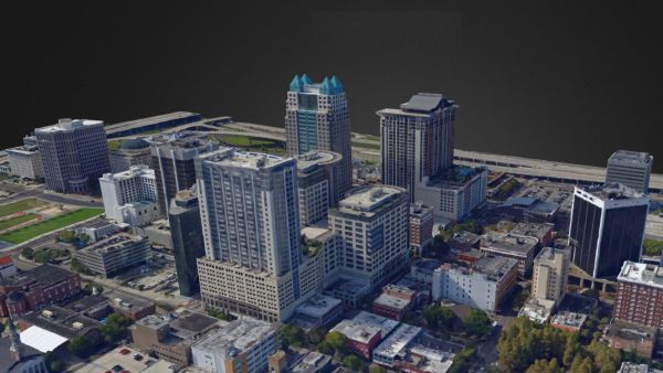
- Vectorize : Generate a TIN to model the ground and create engineering-ready CAD vector files from point cloud data by extracting key elements of your project with PIX4Dsurvey.
- Model : Move from a lightweight point cloud to a model of your terrain. Use the Smart Grid, TIN, and terrain classification to get accurate, actionable results
- Integrate : Open your simplified, accurate data in any CAD or GIS software with custom layers and properties that fit your existing workflow.
PIX4Dsurvey
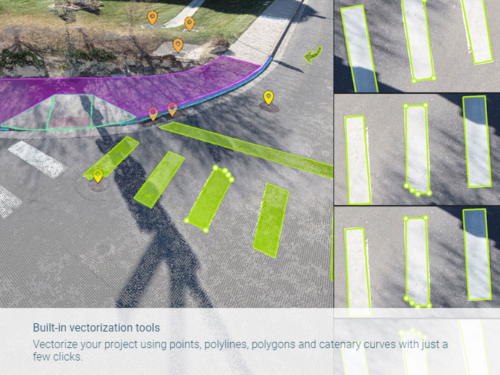
Extract key elements in 3D
- • Built-in vectorization tools Vectorize your project using points, polylines, polygons and catenary curves with just a few clicks.
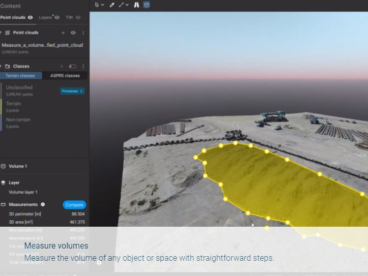
- • Measure volumesMeasure the volume of any object or space with straightforward steps.
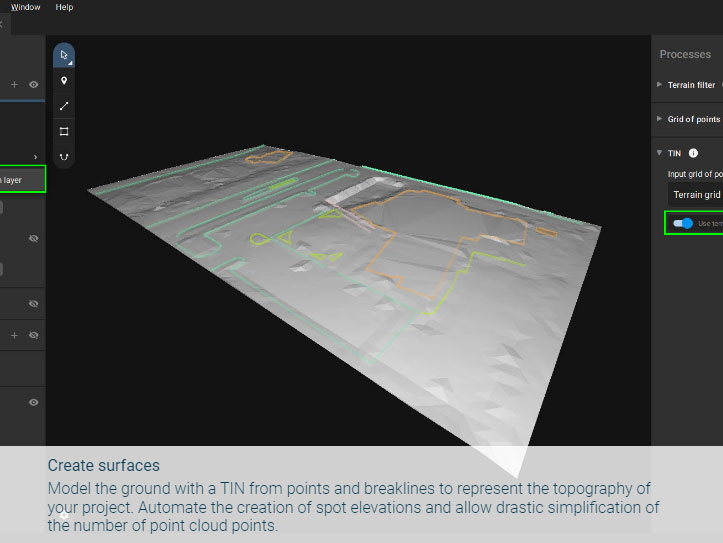
- • Create surfaces Model the ground with a TIN from points and breaklines to represent the topography of your project. Automate the creation of spot elevations and allow drastic simplification of the number of point cloud points.
- • Unlock more data Move beyond photogrammetry, yet still work with Pix4D’s rayCloud to access the original images and 3D point clouds simultaneously. Vectorize in 3D, edit in 2D. Survey complex objects only visible in images. Use color selection to pick a point and search in a defined radius for points of a similar color.
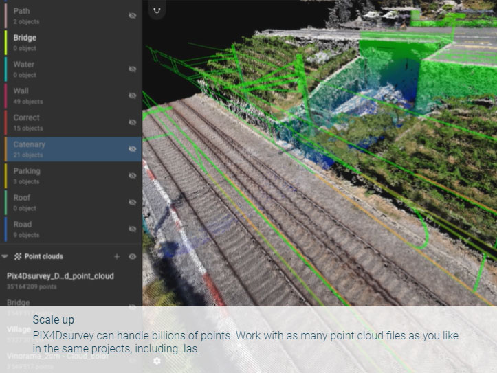
- • Scale upPIX4Dsurvey can handle billions of points. Work with as many point cloud files as you like in the same projects, including .las.
- • Integrated solutionPIX4Dsurvey works with your existing workflows. Import .p4d files from PIX4Dmapper, PIX4Dcloud, or .p4m files from PIX4Dmatic with the click of a button, or work with .las and .laz files from any device/source.
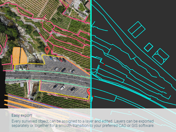
- • Easy export Every surveyed object can be assigned to a layer and edited. Layers can be exported separately or together for a smooth transition to your preferred CAD or GIS software.
Download Brochure
ดาวน์โหลดPIX4Dsurvey
Output
Generate high resolution outputs for any project and use case Easily export your digital maps and models to industry-compatible formats for further analysis or reporting
Color point cloud
The color point cloud uses RGB data from a raster for colorization. Each point of the point cloud receives the RGB value of the raster pixel that has the same location.Output formats: .las, .laz, .ply, .xyz
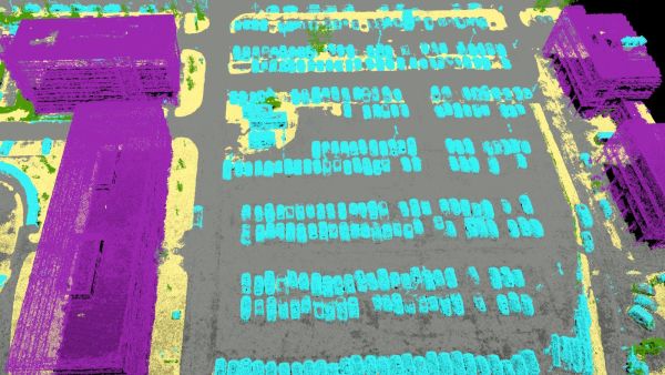
Classified point cloud
The point cloud is classifed in 5 predefined groups: ground, road surface, high vegetation, building, human made object. The results of the classification are used for the DTM generation.Output formats: .las, .laz
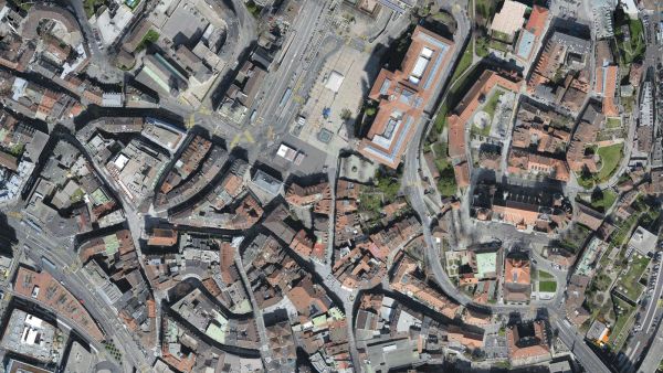
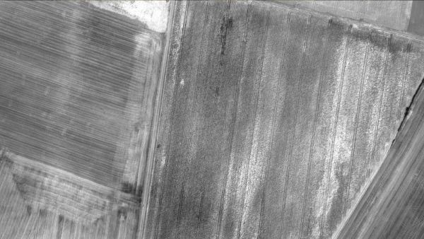
Orthomosaic
2D image map geometrically corrected such that the scale is uniform. Color balanced to be visually pleasing.Output formats: GeoTiff (.tif), .kml
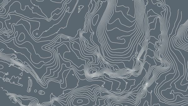
Contour lines
These are lines connecting points of equal elevation. They allow to better understand the shape of the land surface (the topography) on a map.Output formats: .shp, .dxf, .pdf
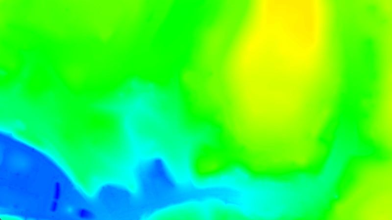
Digital terrain model (DTM)
Digital elevation model (DEM)
2.5 D model of the mapped area after filtering out objects such as buildings, that contains (X,Y,Z) information but no color information.
Output formats: GeoTiff (.tif)
Digital surface model (DSM)
2.5 D model of the mapped area that contains (X,Y,Z) information, but no color information.Output formats: GeoTiff (.tif), .xyz, .las, .laz
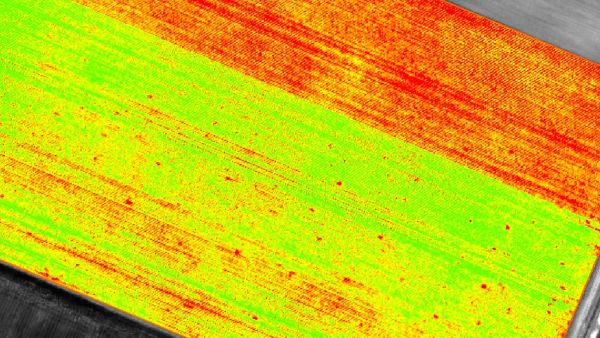
Index maps
Each index is associated to an index map. For each pixel on this map, the value of the pixel is derived from the associated reflectance maps.Output formats: GeoTiff (.tif), .shp
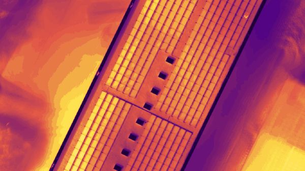
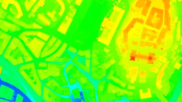
Thermal maps
Thermal maps are 2D maps displaying the thermal information from infrared imaging cameras for each pixel.Output formats: GeoTiff (.tif)
Reflectance maps
A reflectance map compiles the reflectance values of each pixel and geometry into a single function.Output formats: GeoTiff (.tif)
3D textured mesh
A representation of the shape of the model that consists of vertices, edges, faces and the texture from the images that is projected on it..Output formats: .ply, .fbx, .dxf, .obj, .pdf
GET SPECIAL OFFER !!!
รับราคาพิเศษ สำหรับ License แบบซื้อขาดและแบบรายปี กรอกแบบฟอร์มเพื่อขอใบเสนอราคาได้เลย
ขอใบเสนอราคาพิเศษ