


PIX4Dreact
2D fast-mapping for emergency response and public safety
WORK PROCESS
- Capture : Fly your drone to capture the images you need. Plan an optimized and automated flight with an app like PIX4Dcapture for Parrot and DJI drones.
- Process : Combine large numbers of images in minutes with PIX4Dreact. Create measurable 2D maps in the field or back at base.
- Examine : With PIX4Dreact’s simple tools, identify and measure points of interest, mark and evaluate your maps while on the ground to provide powerful data needed to take action.
- Share : Export your maps to ensure teams and decision makers are provided with effective information when it’s needed most.
- Respond : With up-to-date maps, gain precious time, improve safety and reduce costs when responding to an evolving situation.
PIX4Dreact
Reliable situational awareness in complex situations
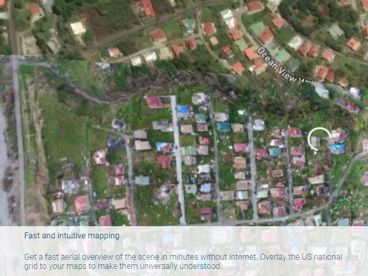
- • Fast and intuitive mappingGet a fast aerial overview of the scene in minutes without internet. Overlay the US national grid to your maps to make them universally understood.
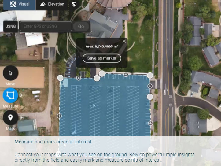
- • Measure and mark areas of interestConnect your maps with what you see on the ground. Rely on powerful rapid insights directly from the field and easily mark and measure points of interest.
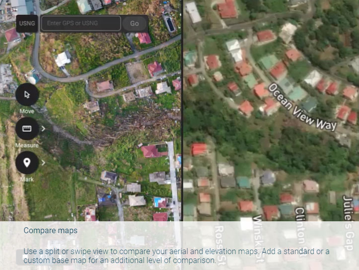
- • Compare mapsUse a split or swipe view to compare your aerial and elevation maps. Add a standard or a custom base map for an additional level of comparison.
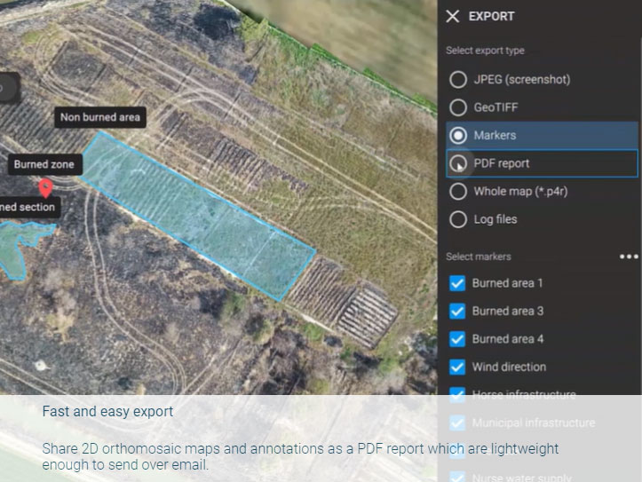
- • Fast and easy exportShare 2D orthomosaic maps and annotations as a PDF report which are lightweight enough to send over email.
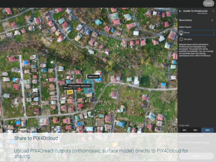
- • Share to PIX4DcloudUpload PIX4Dreact outputs (orthomosaic, surface model) directly to PIX4Dcloud for sharing
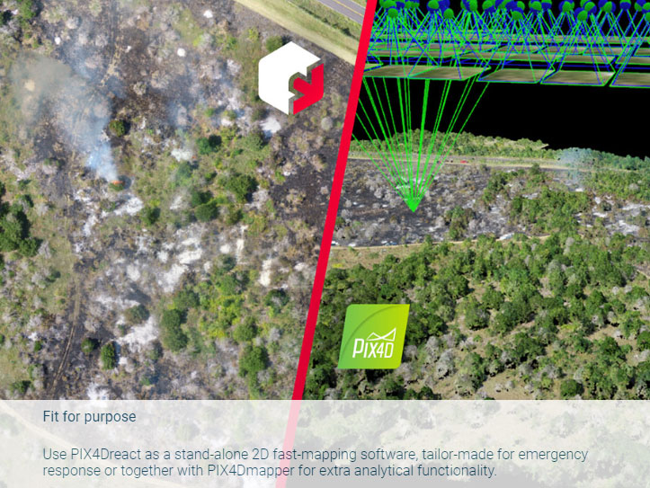
- • Fit for purposeUse PIX4Dreact as a stand-alone 2D fast-mapping software, tailor-made for emergency response or together with PIX4Dmapper for extra analytical functionality.
Download Brochure
ดาวน์โหลดPIX4Dreact
Output
Generate high resolution outputs for any project and use case Easily export your digital maps and models to industry-compatible formats for further analysis or reporting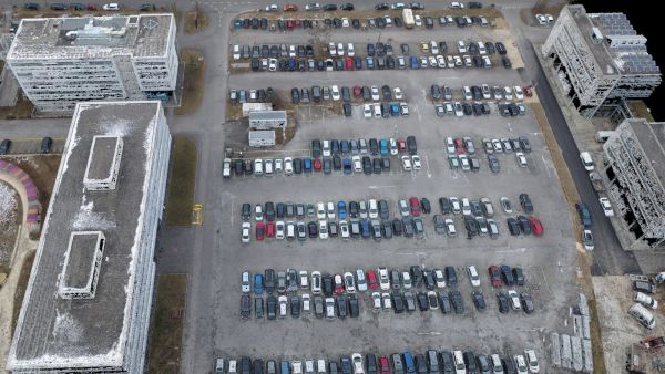
Color point cloud
The color point cloud uses RGB data from a raster for colorization. Each point of the point cloud receives the RGB value of the raster pixel that has the same location.Output formats: .las, .laz, .ply, .xyz
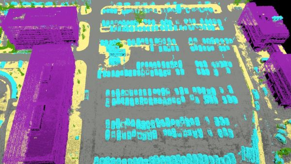
Classified point cloud
The point cloud is classifed in 5 predefined groups: ground, road surface, high vegetation, building, human made object. The results of the classification are used for the DTM generation.Output formats: .las, .laz
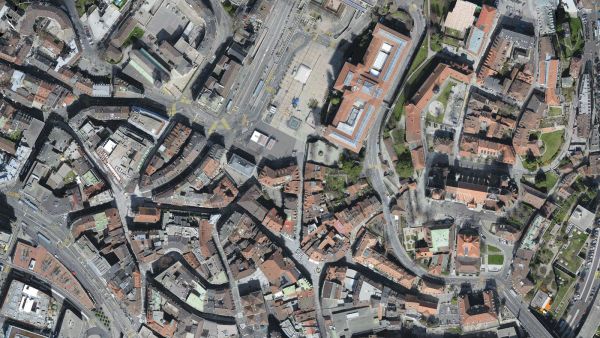
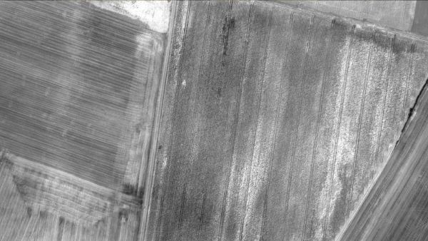
Orthomosaic
2D image map geometrically corrected such that the scale is uniform. Color balanced to be visually pleasing.Output formats: GeoTiff (.tif), .kml
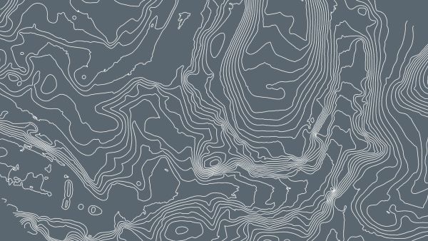
Contour lines
These are lines connecting points of equal elevation. They allow to better understand the shape of the land surface (the topography) on a map.Output formats: .shp, .dxf, .pdf
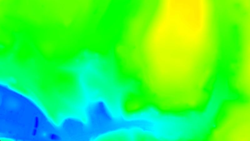
Digital terrain model (DTM)
Digital elevation model (DEM)
2.5 D model of the mapped area after filtering out objects such as buildings, that contains (X,Y,Z) information but no color information.
Output formats: GeoTiff (.tif)
Digital surface model (DSM)
2.5 D model of the mapped area that contains (X,Y,Z) information, but no color information.Output formats: GeoTiff (.tif), .xyz, .las, .laz
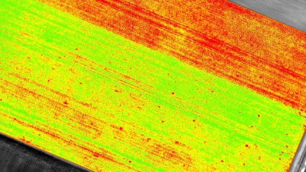
Index maps
Each index is associated to an index map. For each pixel on this map, the value of the pixel is derived from the associated reflectance maps.Output formats: GeoTiff (.tif), .shp
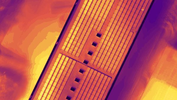
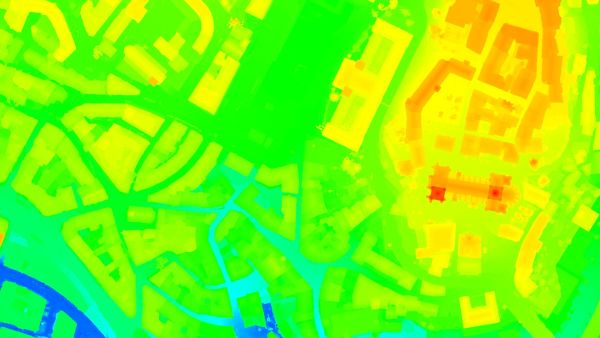
Thermal maps
Thermal maps are 2D maps displaying the thermal information from infrared imaging cameras for each pixel.Output formats: GeoTiff (.tif)
Reflectance maps
A reflectance map compiles the reflectance values of each pixel and geometry into a single function.Output formats: GeoTiff (.tif)
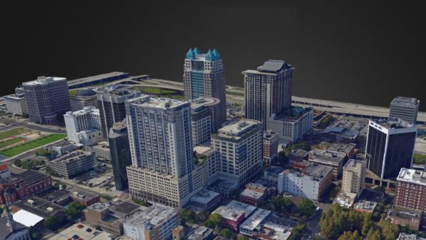
3D textured mesh
A representation of the shape of the model that consists of vertices, edges, faces and the texture from the images that is projected on it..Output formats: .ply, .fbx, .dxf, .obj, .pdf
GET SPECIAL OFFER !!!
รับราคาพิเศษ สำหรับ License แบบซื้อขาดและแบบรายปี กรอกแบบฟอร์มเพื่อขอใบเสนอราคาได้เลย
ขอใบเสนอราคาพิเศษ