


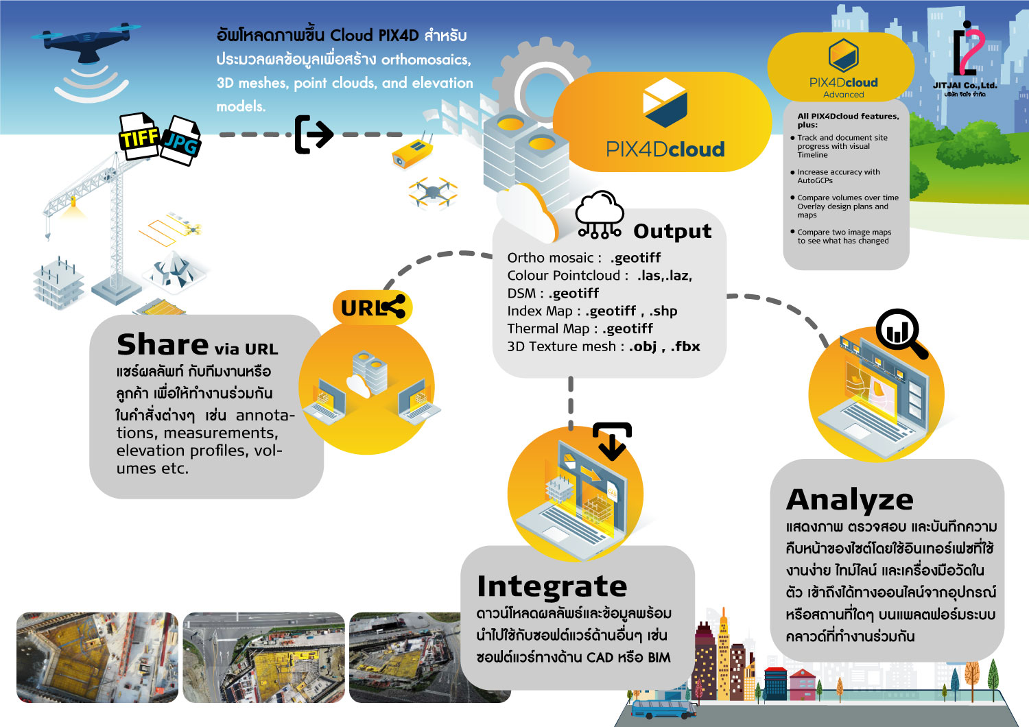
PIX4Dcloud
โปรแกรมเป็นระบบ Cloud Process แพลตฟอร์มออนไลน์ที่ครบครันสำหรับทั้งการสำรวจภาคพื้นดินและการสำรวจด้วยโดรน ช่วยติดตามความคืบหน้าของโครงการและจัดเก็บเอกสารสถานที่
- เก็บภาพสถานที่ด้วยเครื่องมือหลากหลาย ไม่ว่าจะเป็น PIX4Dcatch, viDoc RTK rover, โดรน, กล้องถ่ายภาพพกพา หรือ Pix4D CraneCamera
- ประมวลผลภาพอัตโนมัติบนคลาวด์ด้วยอัลกอริทึมโฟโตแกรมเมตทรี แปลงภาพเป็นข้อมูลที่วัดผลได้ สร้างภาพถ่ายออร์โธโมเสก, ตาข่าย 3 มิติ, จุดเมฆ และโมเดลความสูง ที่แม่นยำและอ้างอิงทางภูมิศาสตร์
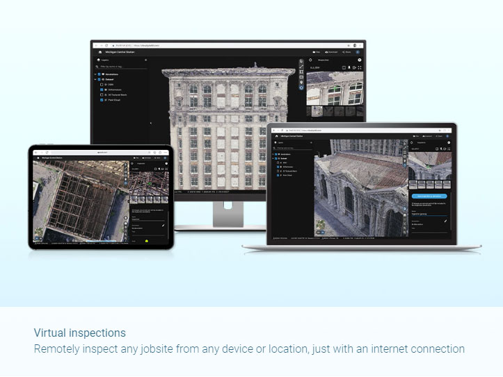
- ติดตาม และบันทึกความคืบหน้าของสถานที่ด้วยอินเตอร์เฟซที่ใช้งานง่าย ไทม์ไลน์ และเครื่องมือวัดในตัว เข้าถึงได้ออนไลน์จากทุกอุปกรณ์และทุกสถานที่ ผ่านแพลตฟอร์มบนคลาวด์ที่รองรับการทำงานร่วมกัน
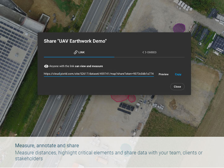
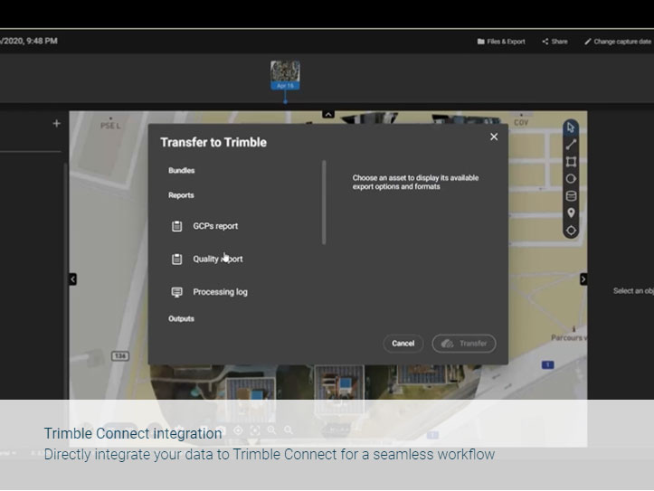
- เพียงแค่แชร์ URL ก็สามารถแบ่งปันผลลัพธ์กับทีมงานหรือลูกค้าของคุณได้อย่างง่ายดาย ส่งเสริมการไหลเวียนข้อมูลและการทำงานร่วมกันอย่างราบรื่น
- ดาวน์โหลดผลลัพธ์ทั้งหมดและส่งออกไปยังซอฟต์แวร์ CAD และ BIM ของบุคคลที่สามสำหรับขั้นตอนต่อไป
กระบวนการทำงาน:
Input ที่รองรับบน PIX4Dcloud
(nadir & oblique), multispectral and terrestrial imagery , any camera (compact, SLR, multispectral, GoPro, in jpg or tiff)
Feature PIX4Dcloud
- สามารถเลือก Template (2D, 3D) ในการประมวลผลได้
- สามารถวัดระยะทางและพื้นที่ได้
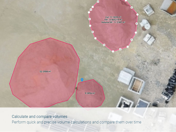
- สามารถวัดปริมาตร
- Elevation profile
- นำเข้าและส่งออก annotations (DXF, SHP, csv, geojson)
- Circle annotations
- Virtual inspector
- Multispectral processing and NDVI display
- Upload existing outputs
- Sharing
Output ที่ได้จากโปรแกรม PIX4Dcloud
2D outputs
- Nadir orthomosaics .tif (GeoTiff)
- 2D vector output .geojson, .shp
2.5D outputs
- DSM/DEM .tif (GeoTiff)
3D outputs
- 3D point cloud .las
- 3D textured mesh .fbx, .obj
Report Output
- Quality report .pdf
PIX4Dcloud Advance - Online Platflorm สำหรับประมวลผล
โปรแกรมเป็นระบบ Cloud Process แพลตฟอร์มออนไลน์ที่ครบครันสำหรับทั้งการสำรวจภาคพื้นดินและการสำรวจด้วยโดรน ช่วยติดตามความคืบหน้าของโครงการและจัดเก็บเอกสารสถานที่ ซึ่ง Feature ที่เพิ่มเติมมาจาก PIX4Dcloud ประกอบด้วย
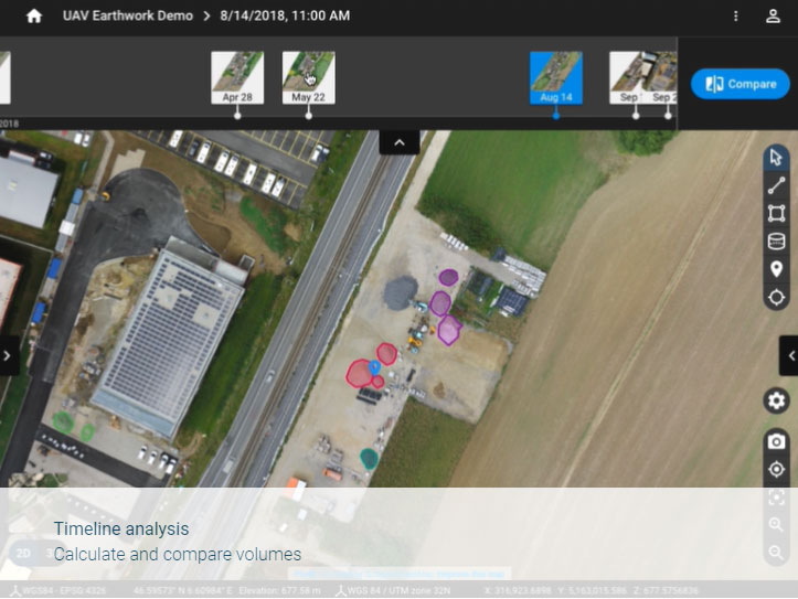
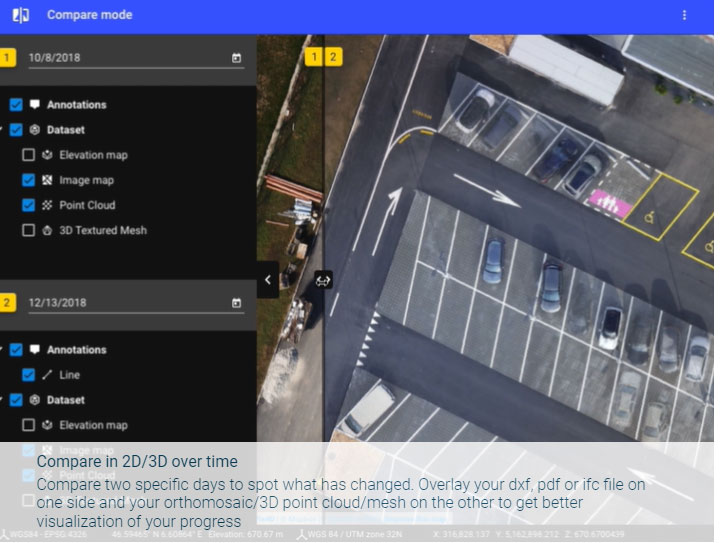
1. Timeline
2. AutoGCPs (automatic Ground Control Points marking)
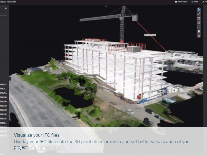
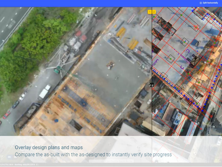
3. 2D/3D Design overlay tool
4. Import BIM models
5. 2D/3D comparison
6. Annotations report
รวมถึงสามารถทำการส่งออก Report GCPs report .pdf และ Annotations report (.pdf)
Download Brochure
ดาวน์โหลดPIX4Dcloud
Output
Generate high resolution outputs for any project and use case Easily export your digital maps and models to industry-compatible formats for further analysis or reporting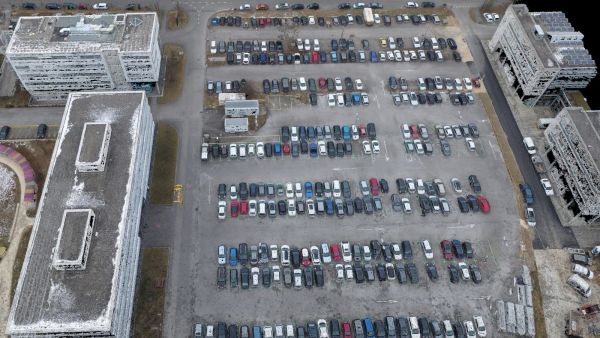
Color point cloud
The color point cloud uses RGB data from a raster for colorization. Each point of the point cloud receives the RGB value of the raster pixel that has the same location.Output formats: .las, .laz, .ply, .xyz
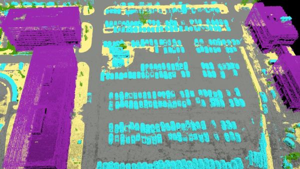
Classified point cloud
The point cloud is classifed in 5 predefined groups: ground, road surface, high vegetation, building, human made object. The results of the classification are used for the DTM generation.Output formats: .las, .laz
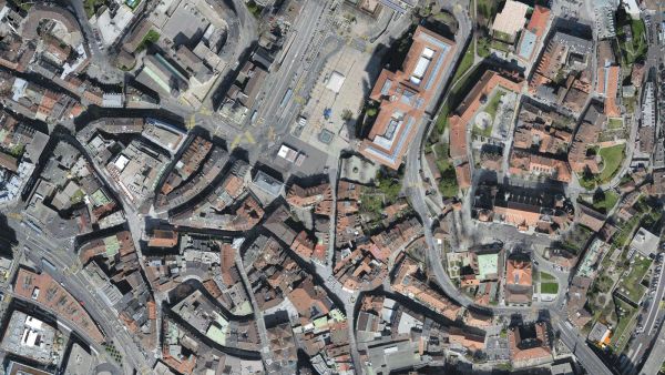
Orthomosaic
2D image map geometrically corrected such that the scale is uniform. Color balanced to be visually pleasing.Output formats: GeoTiff (.tif), .kml
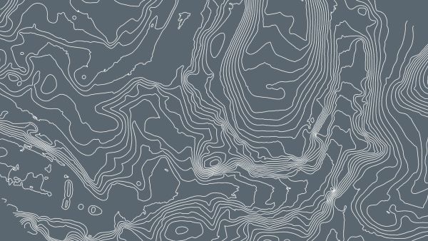
Contour lines
These are lines connecting points of equal elevation. They allow to better understand the shape of the land surface (the topography) on a map.Output formats: .shp, .dxf, .pdf
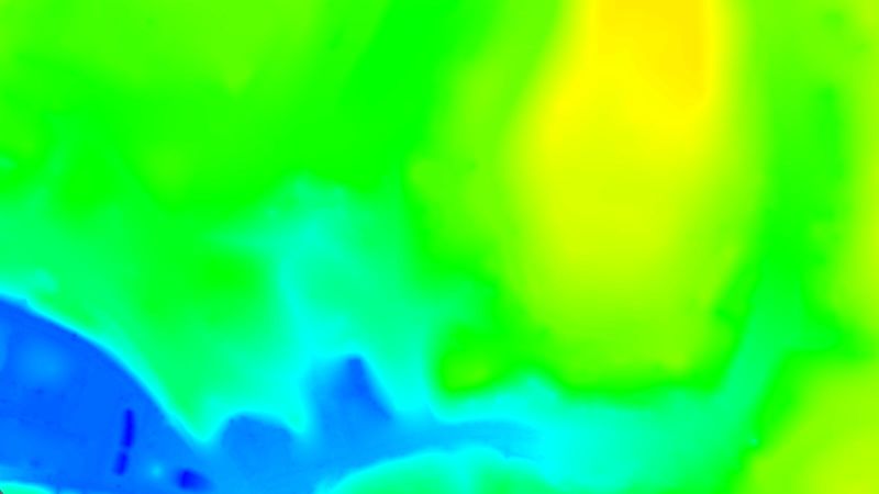
Digital terrain model (DTM)
Digital elevation model (DEM)
2.5 D model of the mapped area after filtering out objects such as buildings, that contains (X,Y,Z) information but no color information.
Output formats: GeoTiff (.tif)
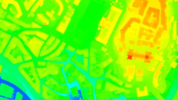
Digital surface model (DSM)
2.5 D model of the mapped area that contains (X,Y,Z) information, but no color information.Output formats: GeoTiff (.tif), .xyz, .las, .laz
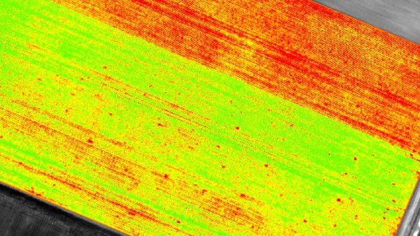
Index maps
Each index is associated to an index map. For each pixel on this map, the value of the pixel is derived from the associated reflectance maps.Output formats: GeoTiff (.tif), .shp
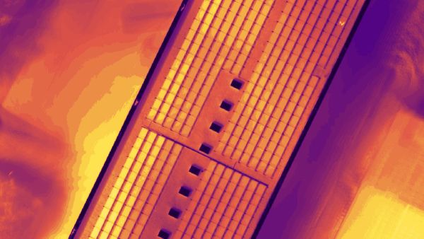
Thermal maps
Thermal maps are 2D maps displaying the thermal information from infrared imaging cameras for each pixel.Output formats: GeoTiff (.tif)
Reflectance maps
A reflectance map compiles the reflectance values of each pixel and geometry into a single function.Output formats: GeoTiff (.tif)
3D textured mesh
A representation of the shape of the model that consists of vertices, edges, faces and the texture from the images that is projected on it..Output formats: .ply, .fbx, .dxf, .obj, .pdf
GET SPECIAL OFFER !!!
รับราคาพิเศษ สำหรับ License แบบซื้อขาดและแบบรายปี กรอกแบบฟอร์มเพื่อขอใบเสนอราคาได้เลย
ขอใบเสนอราคาพิเศษ