


PIX4Dengine
Build the future of digitized reality with our fully customizable photogrammetry reconstruction engine
What is PIX4Dengine?
PIX4Dengine is a set of programming modules accessible via Application Programming Interfaces (APIs) and Software Developing Kits (SDKs) for extracting critical information from images, running on your infrastructure or on our cloud, and compatible with other Pix4D solutions.
Our interfaces are built to empower customization, automation and integration into any enterprise system and reality-capture workflows for photogrammetry.
Your customized workflow. Your competitive advantage.
- Build the photogrammetry software you need : Combine PIX4Dengine with our cloud or with your own platform to create the most efficient mix of flexibility and productivity for your business.
- Streamline data management : Store data where you need it: on your infrastructure or on our secured cloud.Control access to your data, forward processed outputs to users for an interactive review with PIX4Dcloud and share them into your enterprise system.
- Automate at scale : Use our powerful programmatic interface to control data handling, and automate time-consuming and repetitive tasks. Tune algorithmic parameters, build custom logic based on data inputs, and scale your processing pipeline to drastically reduce human oversight.
PIX4Dengine
Maximize your productivity with specialized features
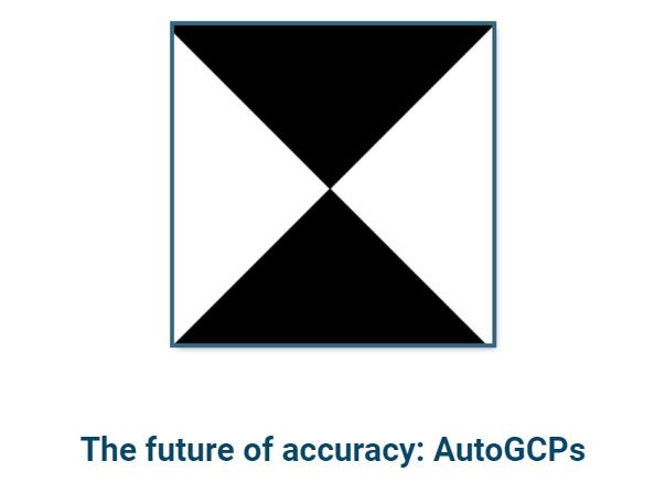
- • The future of accuracy: AutoGCPsThe AutoGCPs feature automatically detects Ground Control Points (GCPs) in your project. A combination of machine learning and computer vision pinpoints the exact center of a GCP with pixel-level accuracy. AutoGCPs work with three types of target Haar patterns: square, diagonal and Aeropoints.
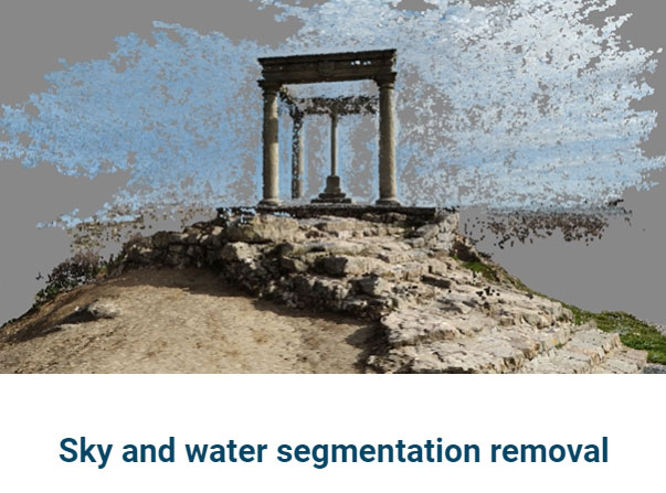
- • Sky and water segmentation removalReduce or completely eliminate noise created by sky and water segments with this new feature. Automatically remove the segments that introduce noise to the point cloud to get smoother, noise-free point clouds and meshes.
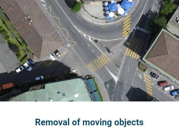
- • Removal of moving objectsWith the moving object removal feature, you can automatically tidy your project by removing moving objects that clutter up your orthomosaics. Focus on the important areas and objects to get cleaner, more accurate representations of your project.
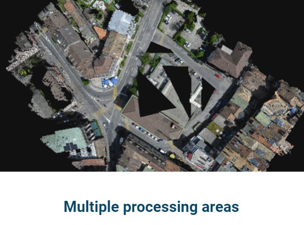
- • Multiple processing areasSet up a field of focus to protect the privacy of the surrounding areas. Generate outputs reflecting just the target areas (of any shape and number). Apply the selected area to the point cloud, mesh, DSM, and orthomosaic to get more relevant results and eliminate unneeded areas
Download Brochure
ดาวน์โหลดPIX4D
Output
Generate high resolution outputs for any project and use case Easily export your digital maps and models to industry-compatible formats for further analysis or reporting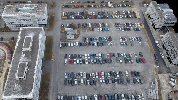
Color point cloud
The color point cloud uses RGB data from a raster for colorization. Each point of the point cloud receives the RGB value of the raster pixel that has the same location.Output formats: .las, .laz, .ply, .xyz
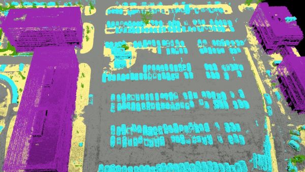
Classified point cloud
The point cloud is classifed in 5 predefined groups: ground, road surface, high vegetation, building, human made object. The results of the classification are used for the DTM generation.Output formats: .las, .laz
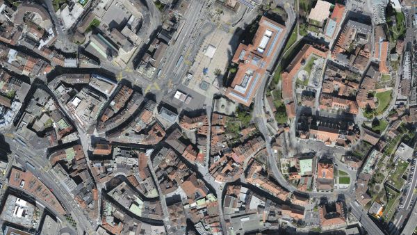
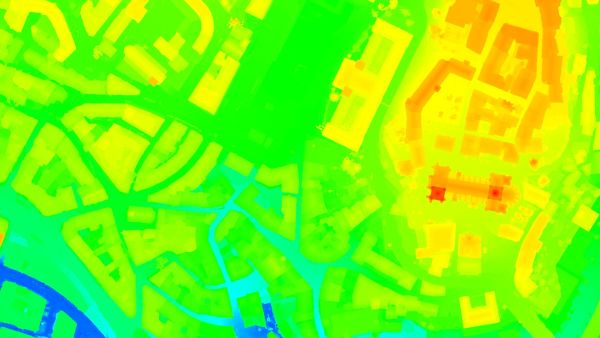
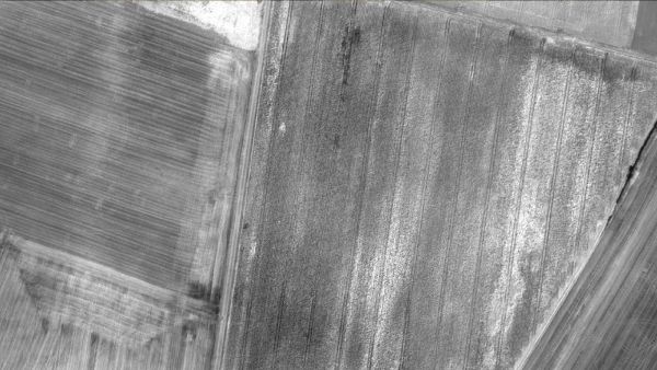
Orthomosaic
2D image map geometrically corrected such that the scale is uniform. Color balanced to be visually pleasing.Output formats: GeoTiff (.tif), .kml
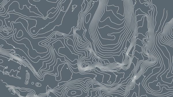
Contour lines
These are lines connecting points of equal elevation. They allow to better understand the shape of the land surface (the topography) on a map.Output formats: .shp, .dxf, .pdf
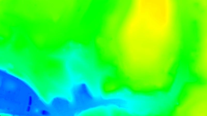
Digital terrain model (DTM)
Digital elevation model (DEM)
2.5 D model of the mapped area after filtering out objects such as buildings, that contains (X,Y,Z) information but no color information.
Output formats: GeoTiff (.tif)
Digital surface model (DSM)
2.5 D model of the mapped area that contains (X,Y,Z) information, but no color information.Output formats: GeoTiff (.tif), .xyz, .las, .laz
Index maps
Each index is associated to an index map. For each pixel on this map, the value of the pixel is derived from the associated reflectance maps.Output formats: GeoTiff (.tif), .shp
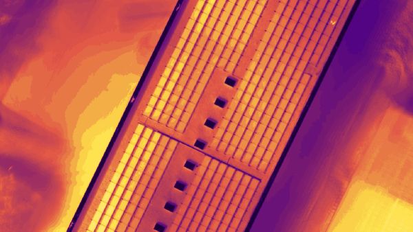
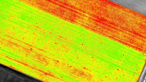
Thermal maps
Thermal maps are 2D maps displaying the thermal information from infrared imaging cameras for each pixel.Output formats: GeoTiff (.tif)
Reflectance maps
A reflectance map compiles the reflectance values of each pixel and geometry into a single function.Output formats: GeoTiff (.tif)
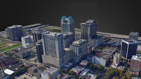
3D textured mesh
A representation of the shape of the model that consists of vertices, edges, faces and the texture from the images that is projected on it..Output formats: .ply, .fbx, .dxf, .obj, .pdf
GET SPECIAL OFFER !!!
รับราคาพิเศษ สำหรับ License แบบซื้อขาดและแบบรายปี กรอกแบบฟอร์มเพื่อขอใบเสนอราคาได้เลย
ขอใบเสนอราคาพิเศษ